
The Best New Zealand Short Walks and Hikes You Need to Do in 2022:
- Hooker Valley Track (Mt Cook Aoraki)
- Taranaki Falls Loop (Tongariro)
- Blue Pools Track
- Cathedral Cove Walk
- Tasman Glacier View Walk
- Redwood Quarry Track (Rotorua)
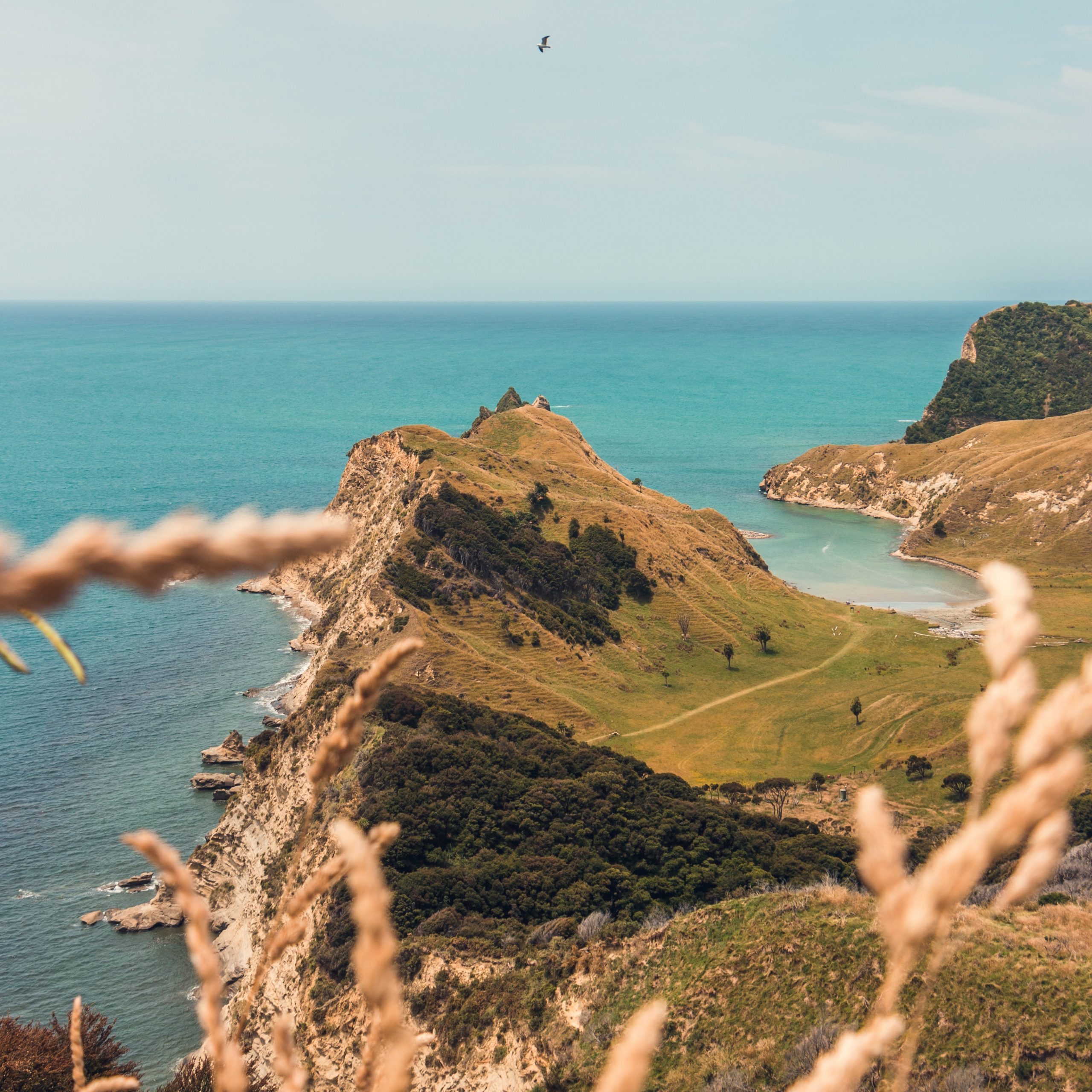
- Kaikoura Peninsula Walkway
- Sealy Tarns Track (Mt Cook Aoraki)
- Spa Park to Huka Falls Walk
- Franz Josef Glacier Track
- Pitt Head Loop (Abel Tasman)
- Lake Pukaki Shoreline Walk
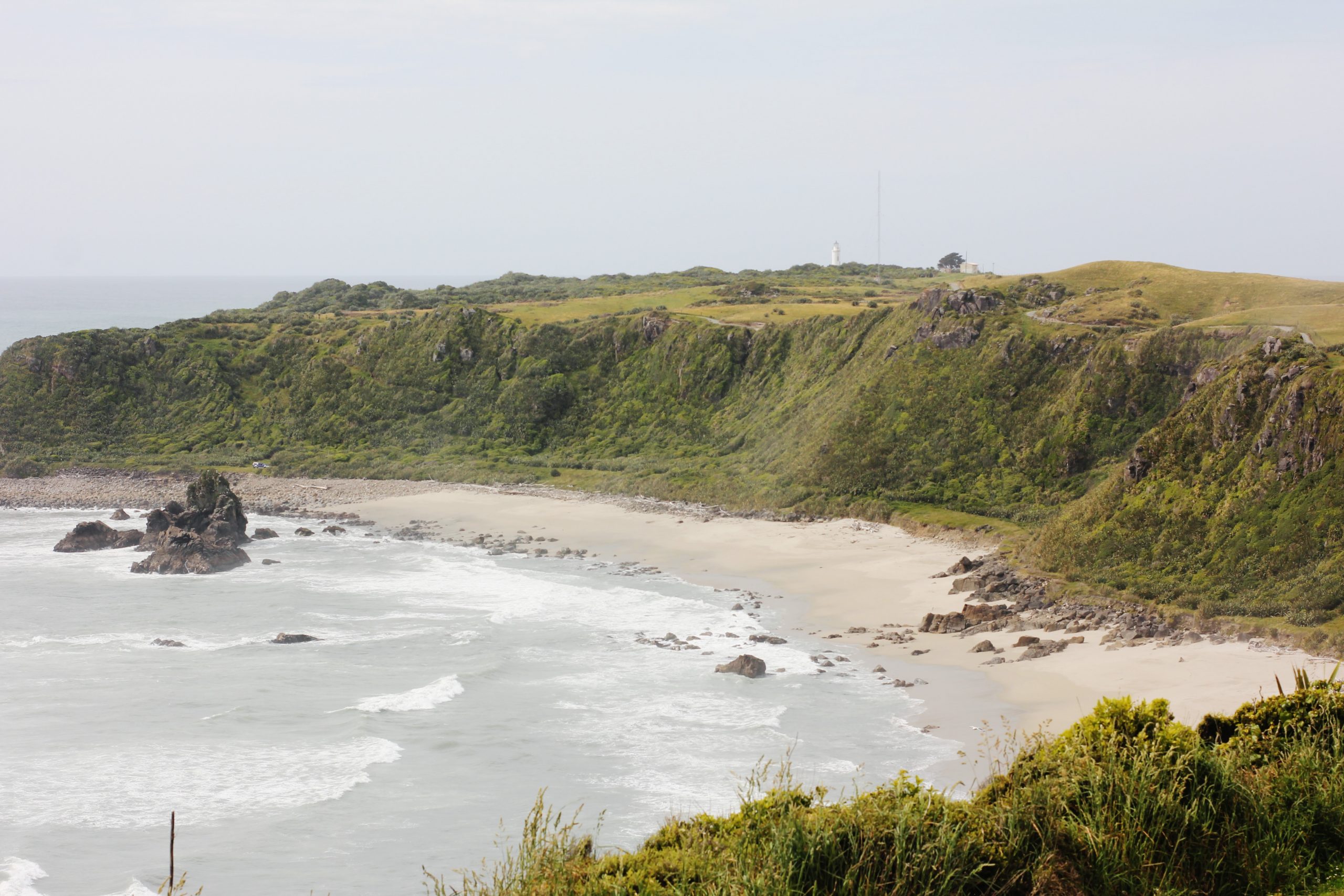
- Cape Reinga Lighthouse Trail
- Wilkies Pools Loop Track (Mt Taranaki)
- Lake Matheson Loop Trail
- Waiheke Island Short Loop
- Mt John Summit (Lake Tekapo)
- Mount Maunganui Track
- Queenstown Hill Walkway
- Hokitika Gorge Walk
- Onahau Lookout Track (Marlborough Sounds)
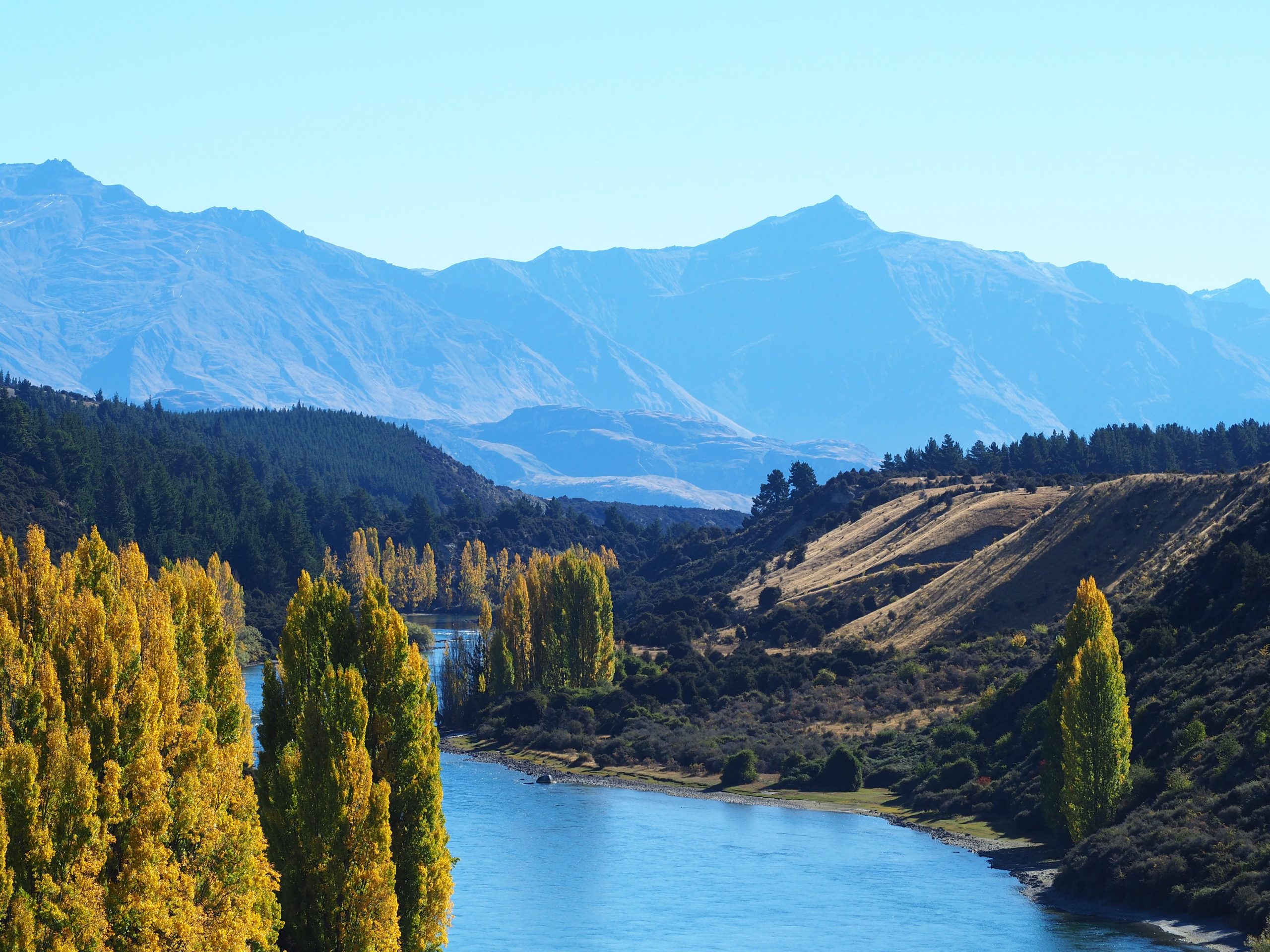
- The Outlet Track (Lake Wanaka)
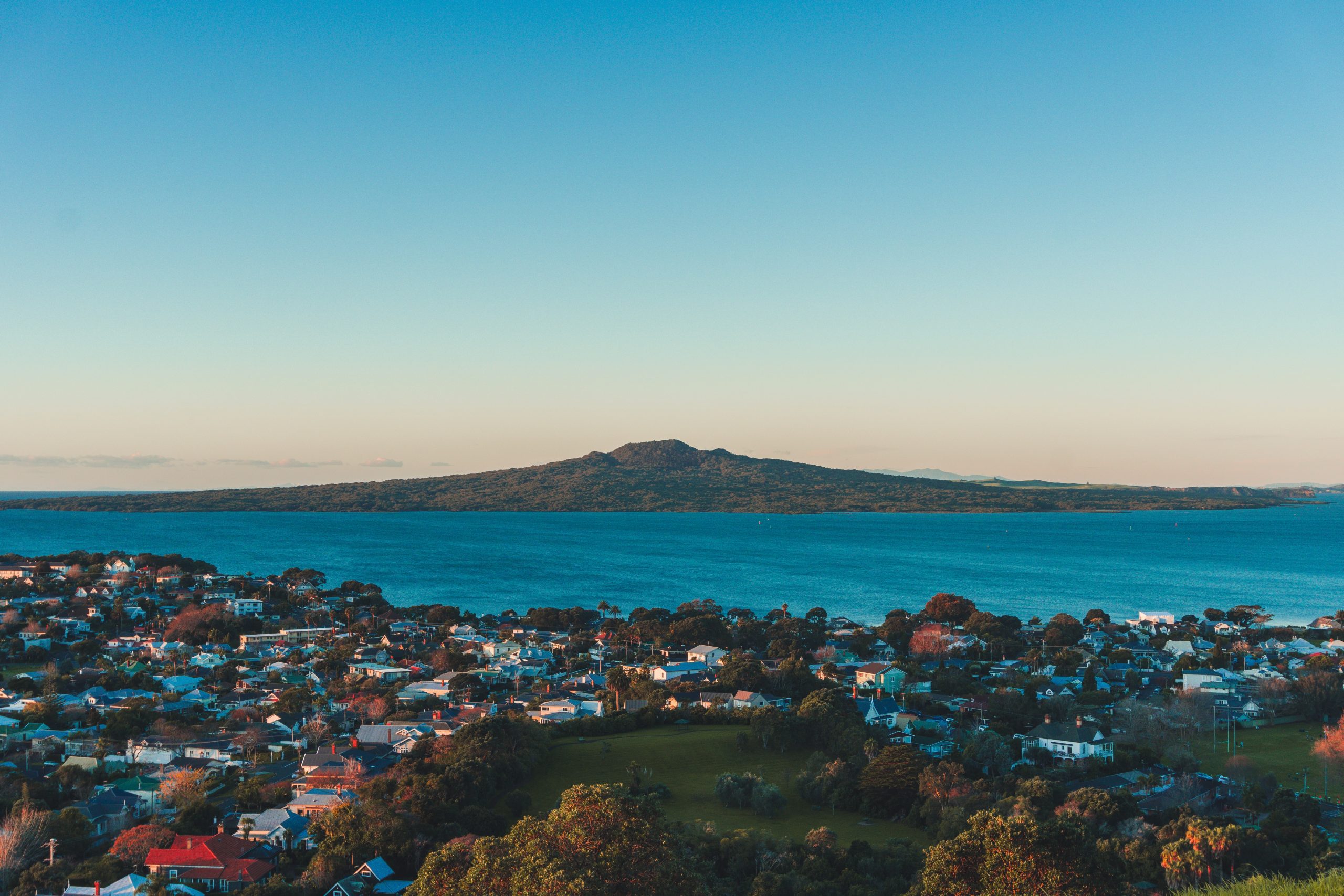
- Rangitoto Summit Track (Auckland)
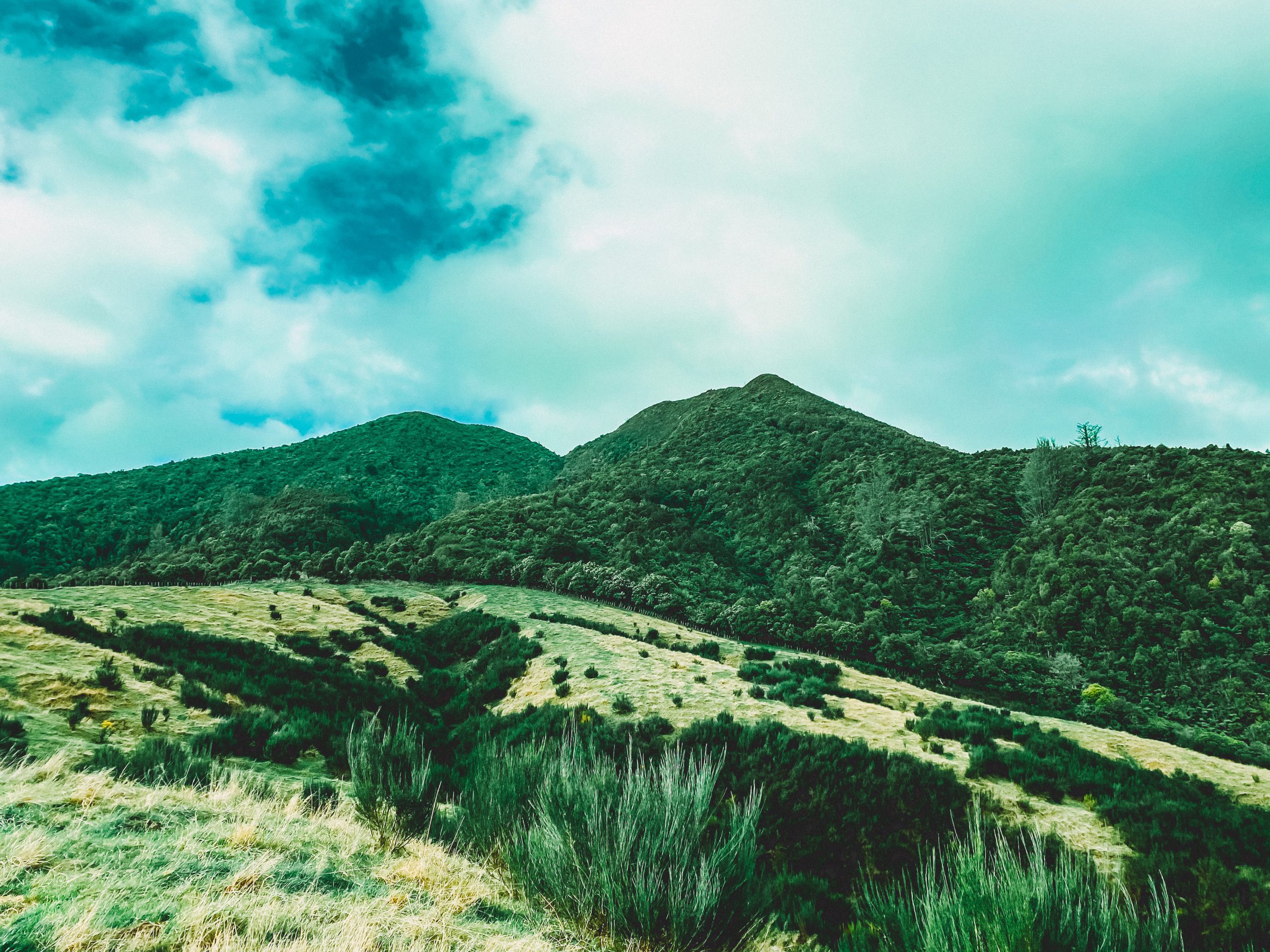
- Mount Tauhara Track (Lake Taupo)
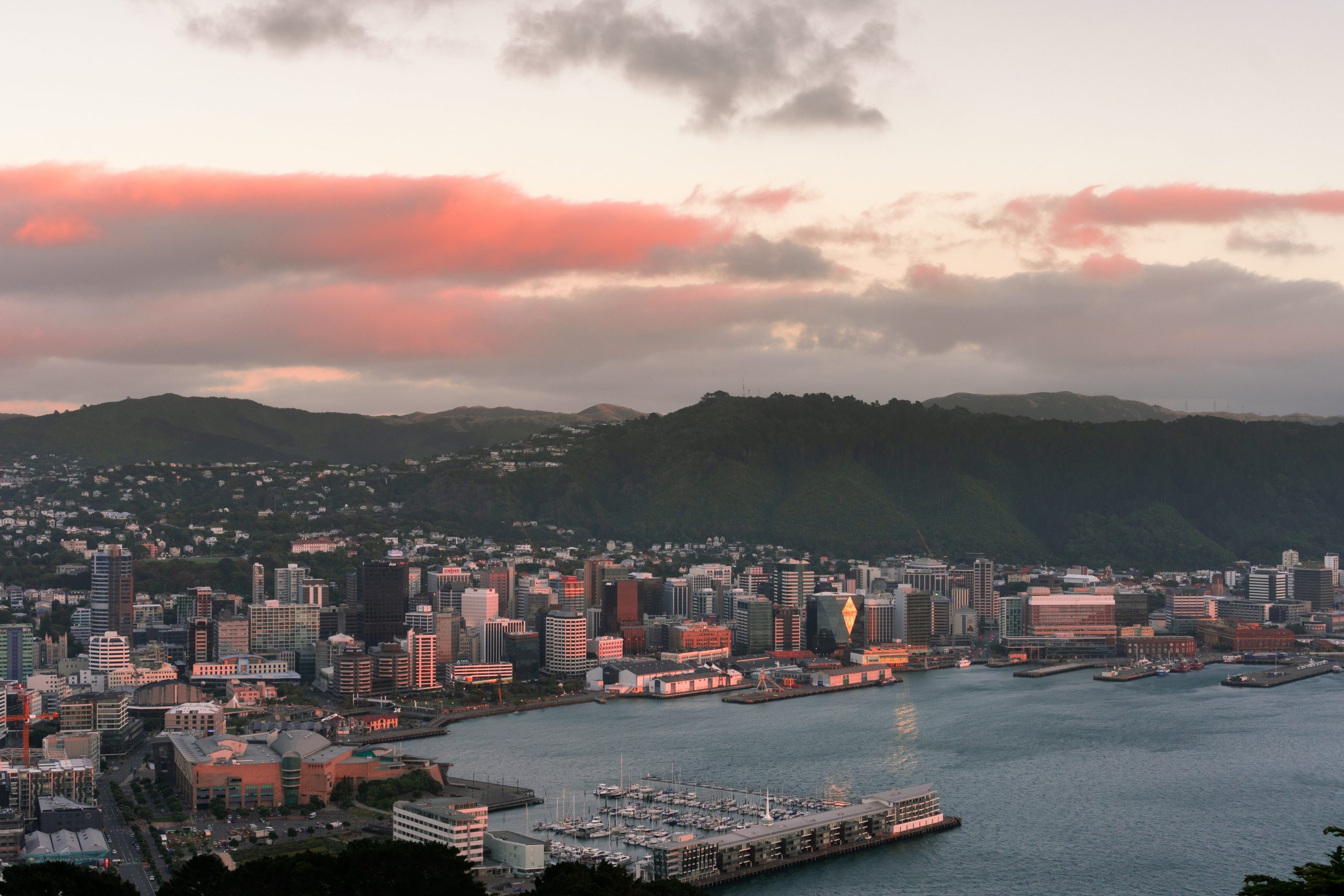
- Mount Victoria Lookout (Wellington)
- Christchurch Adventure Park Walking Track
- Glenorchy Lagoon Scenic Walkway
- Sawpit Gully Track (Arrowtown)
- Kura-Tawhiti Access Track
- Devil’s Punchbowl Lookout Trail
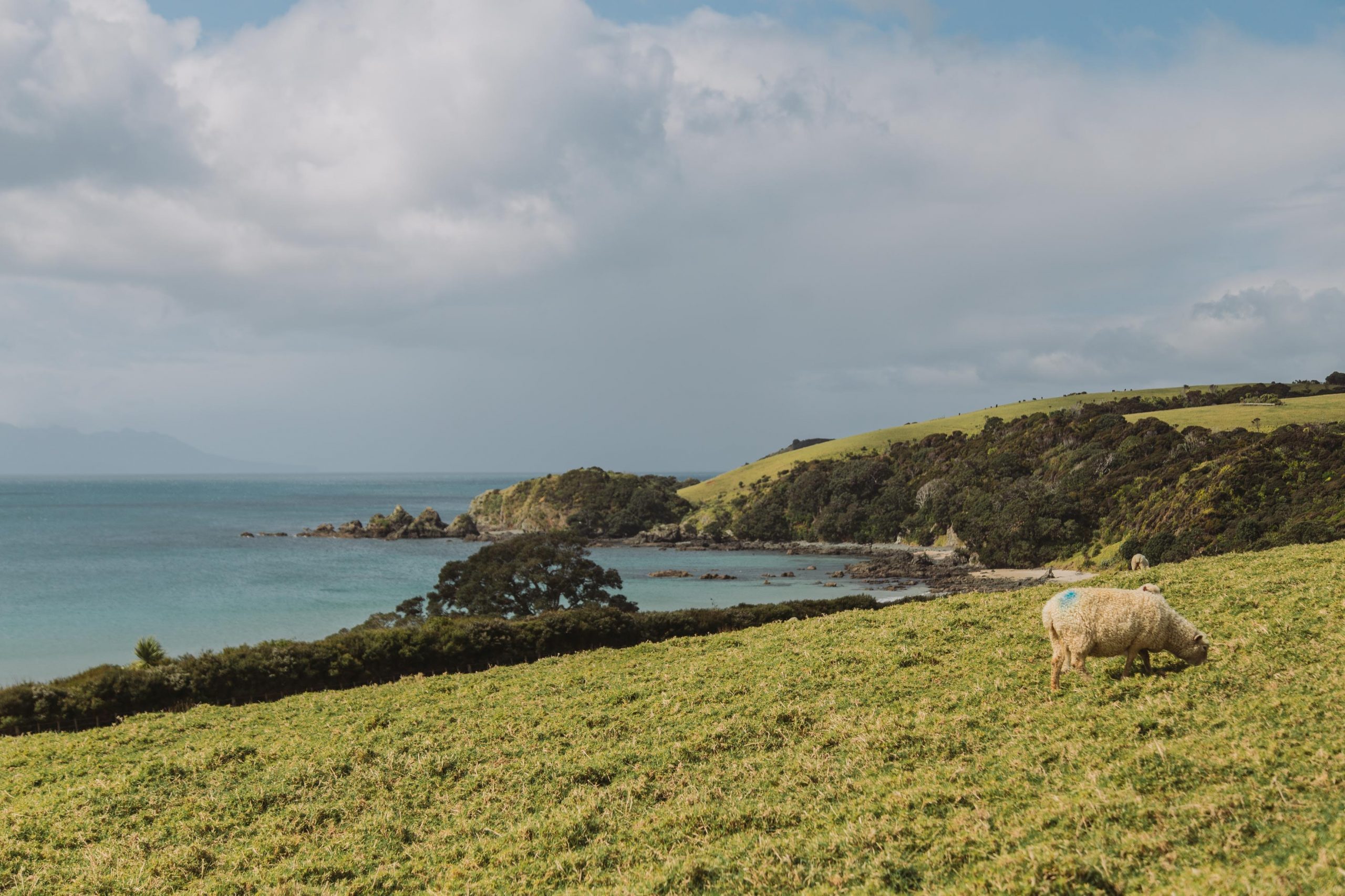
- Mangawhai Cliffs Walkway
- Picton Snout Track
- Castlepoint Track
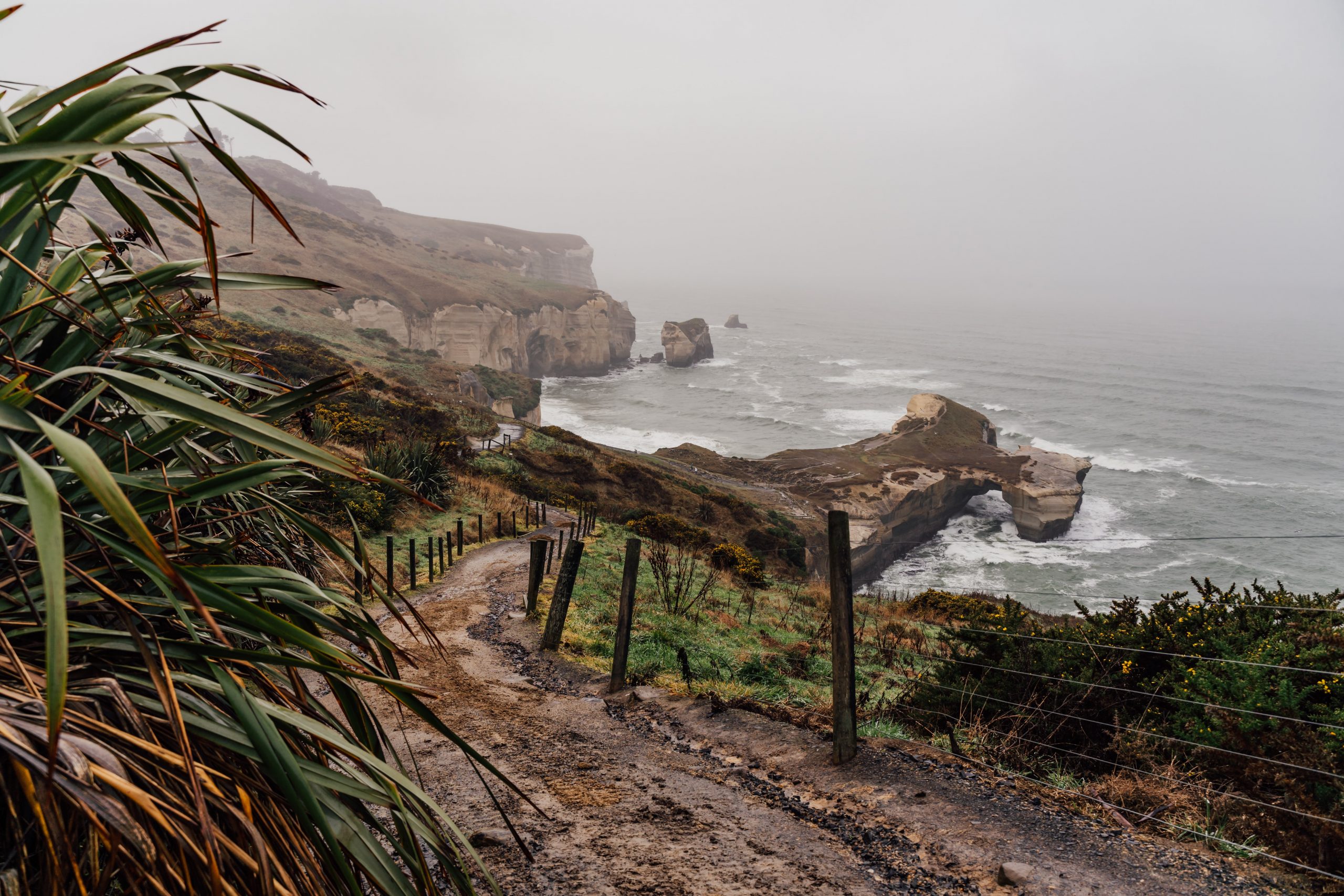
- Tunnel Beach Walkway (Dunedin)
- Cooks Cove Walkway
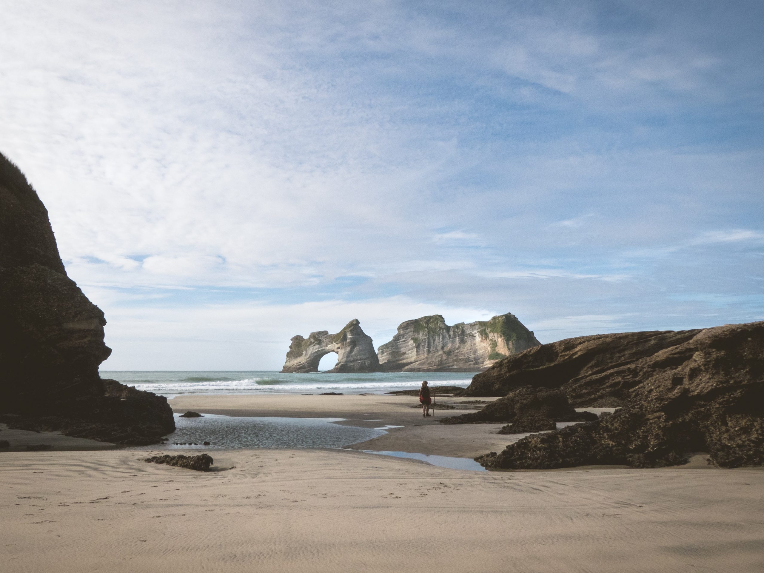
- Wharariki Beach Loop
- Putangirua Pinnacles Track Loop
- Tawharanui Ecology Path
- Cape Foulwind Walkway
- Blue Spring via Te Waihou Walkway
- Rakaia Gorge Walkway
- Mount Manaia Track
- Pororari River Track
- Matiu/ Somes Island Loop Trail (Wellington)
- Tapeka Point Track
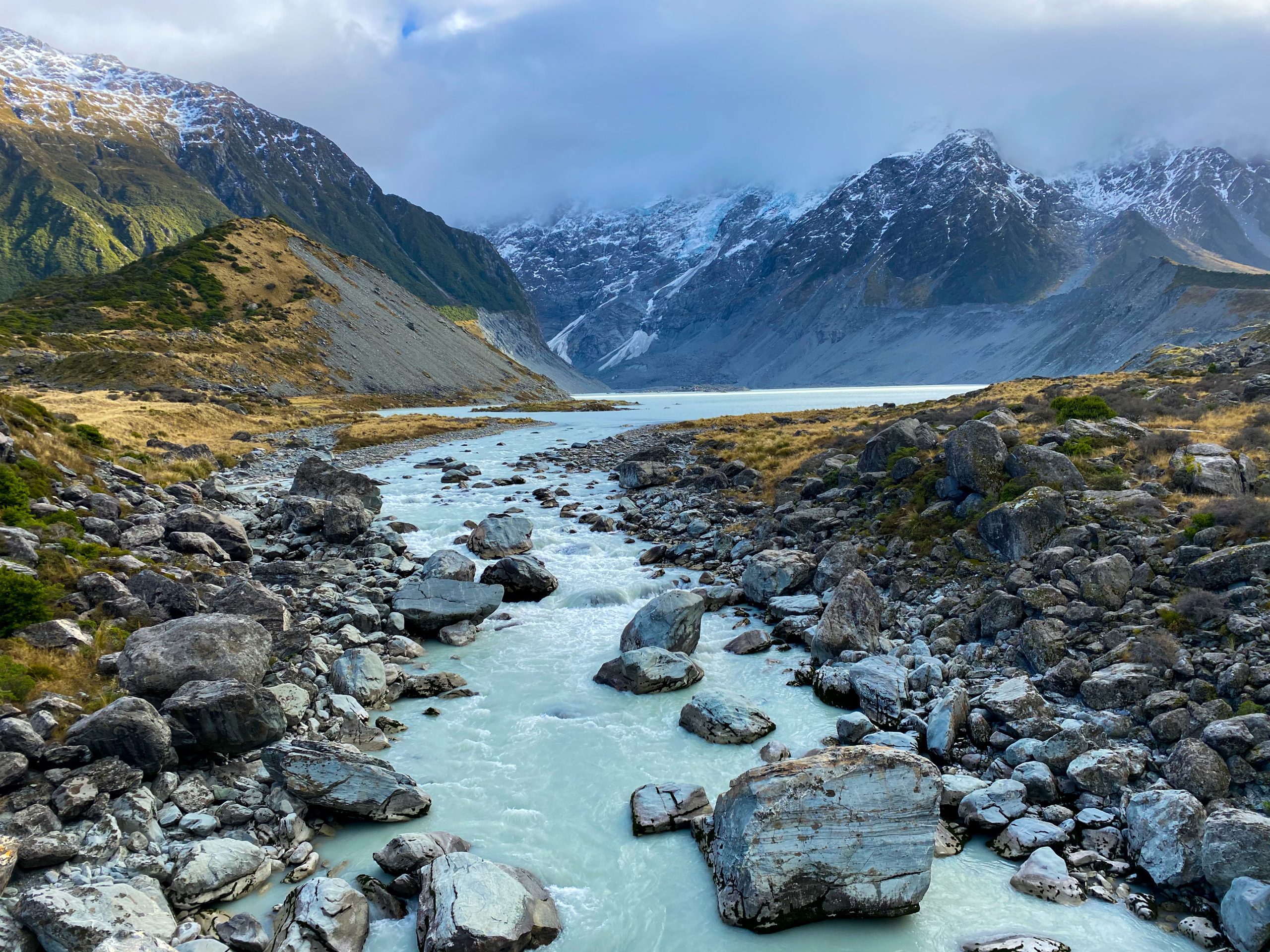
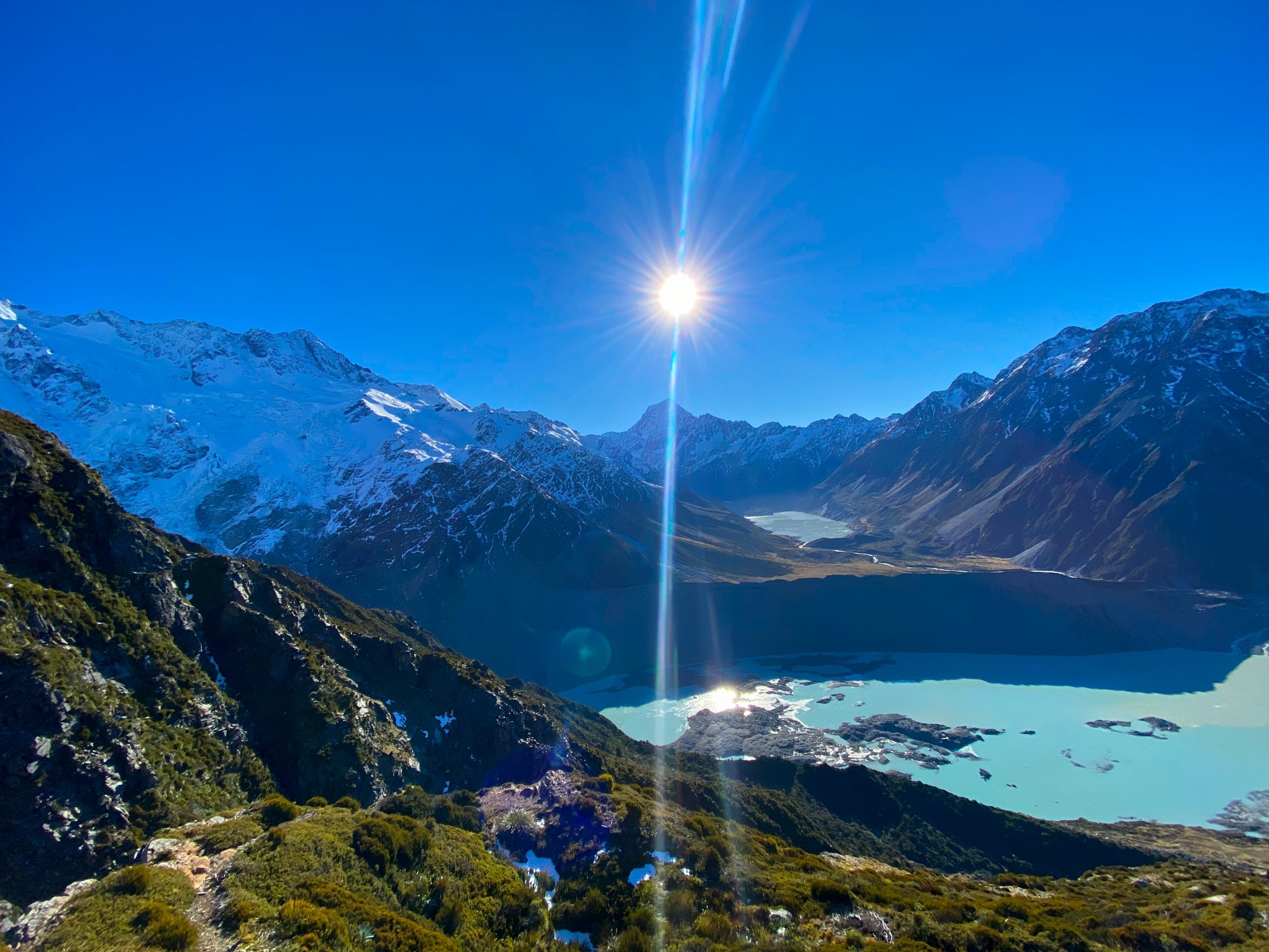
1. Hooker Valley Track (Mt Cook Aoraki)
Length: 10km return
Time: 2h 30 min
Start point: White Horse Hill Campground
Walk highlights: A fantastic moderate walk that follows the Hooker River across swing-bridges and past the Lake Müller lookout, before arriving at Hooker Lake. The relatively flat gravel path winds through the Hooker Valley. You’ll be amazed by the pale turquoise colour of the glacial lakes and rivers, which are filled with silt from the glaciers. My favourite of the New Zealand short walks!
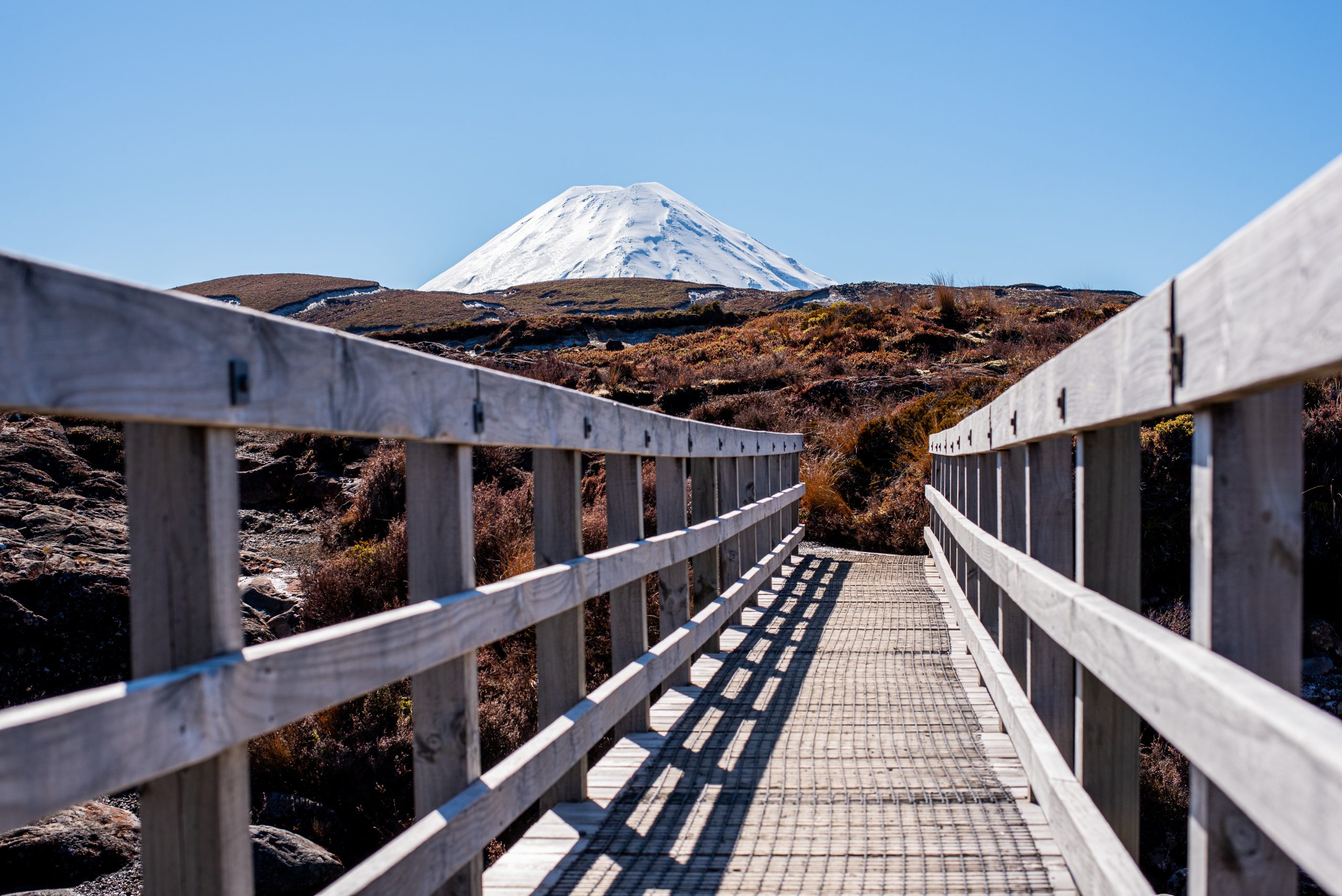
2. Taranaki Falls Loop (Tongariro National Park)
Length: 6km circular
Time: 1h 30 min
Start point: Whakapapa Village
Walk highlights: A waterfall walk in Tongariro National Park. This area is most famous for the full day Tongariro Alpine Crossing hike, but families or those short of time may wish to do this quick walk instead, which still offers views of Mount Ngauruhoe (Mount Doom from Lord of the Rings).
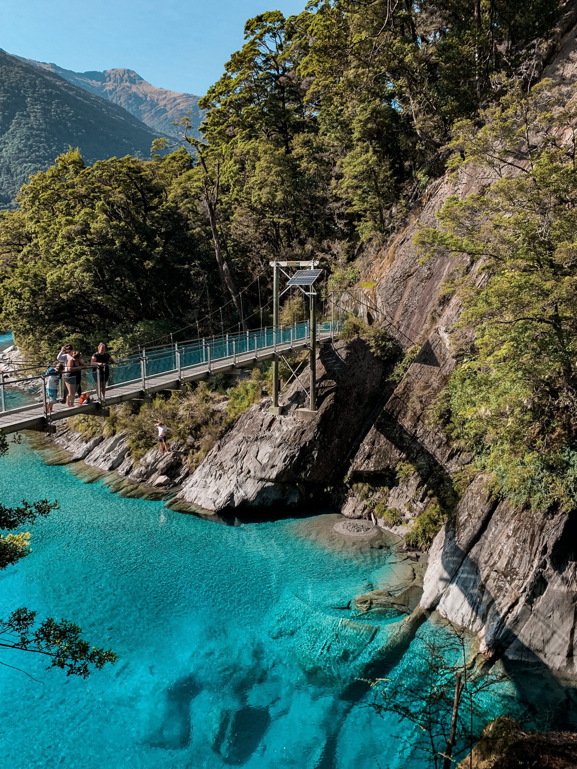
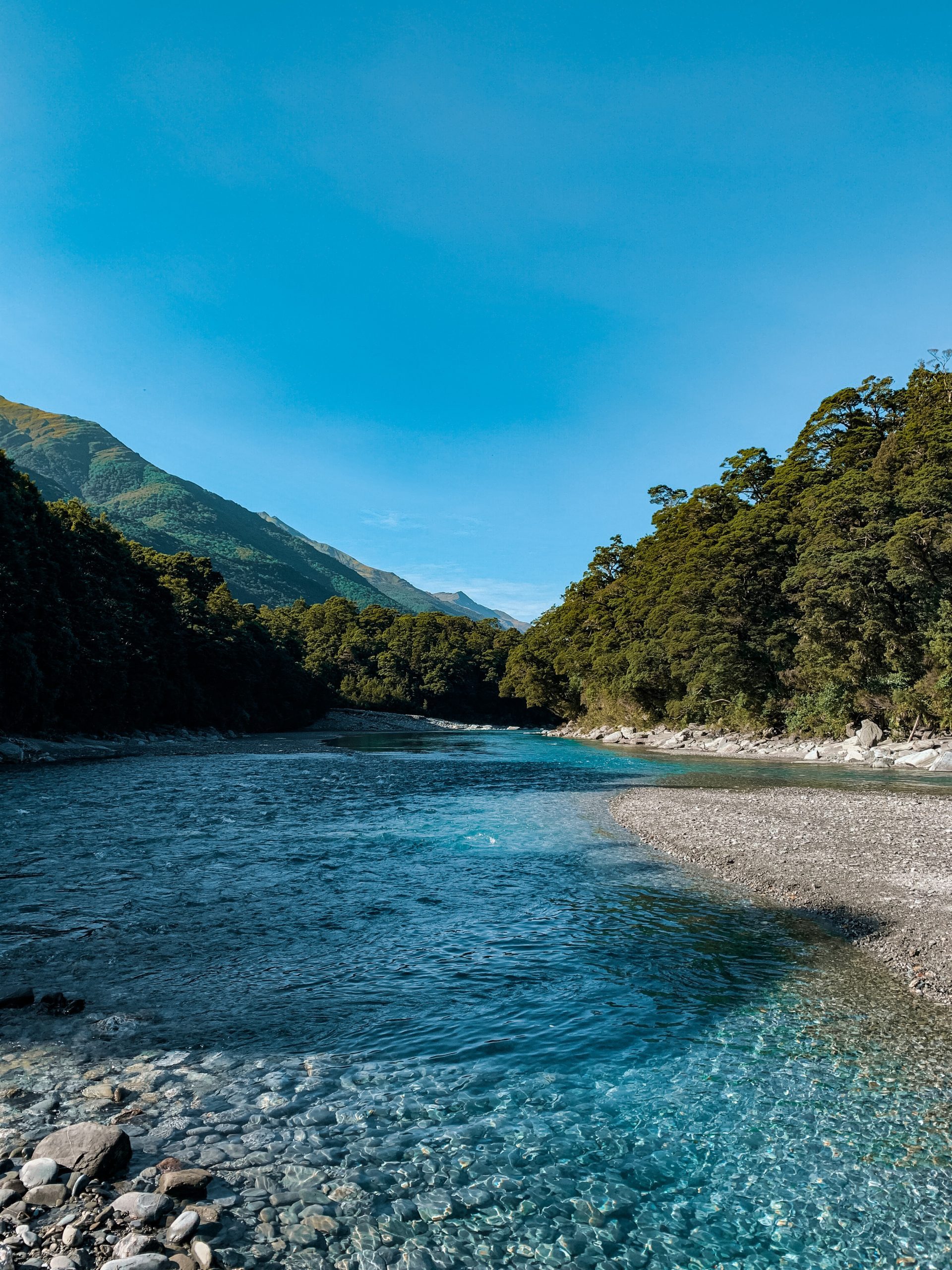
3. Blue Pools Track (Mt Aspiring)
Length: 3.2km return
Time: 50 min
Start point: Car park opposite Cameron Flat Campsite
Walk highlights: An easy walk over swing-bridges in Mount Aspiring National Park to the clear turquoise waters of Blue Pools. You really won’t believe the colour of it!
4. Cathedral Cove Walk
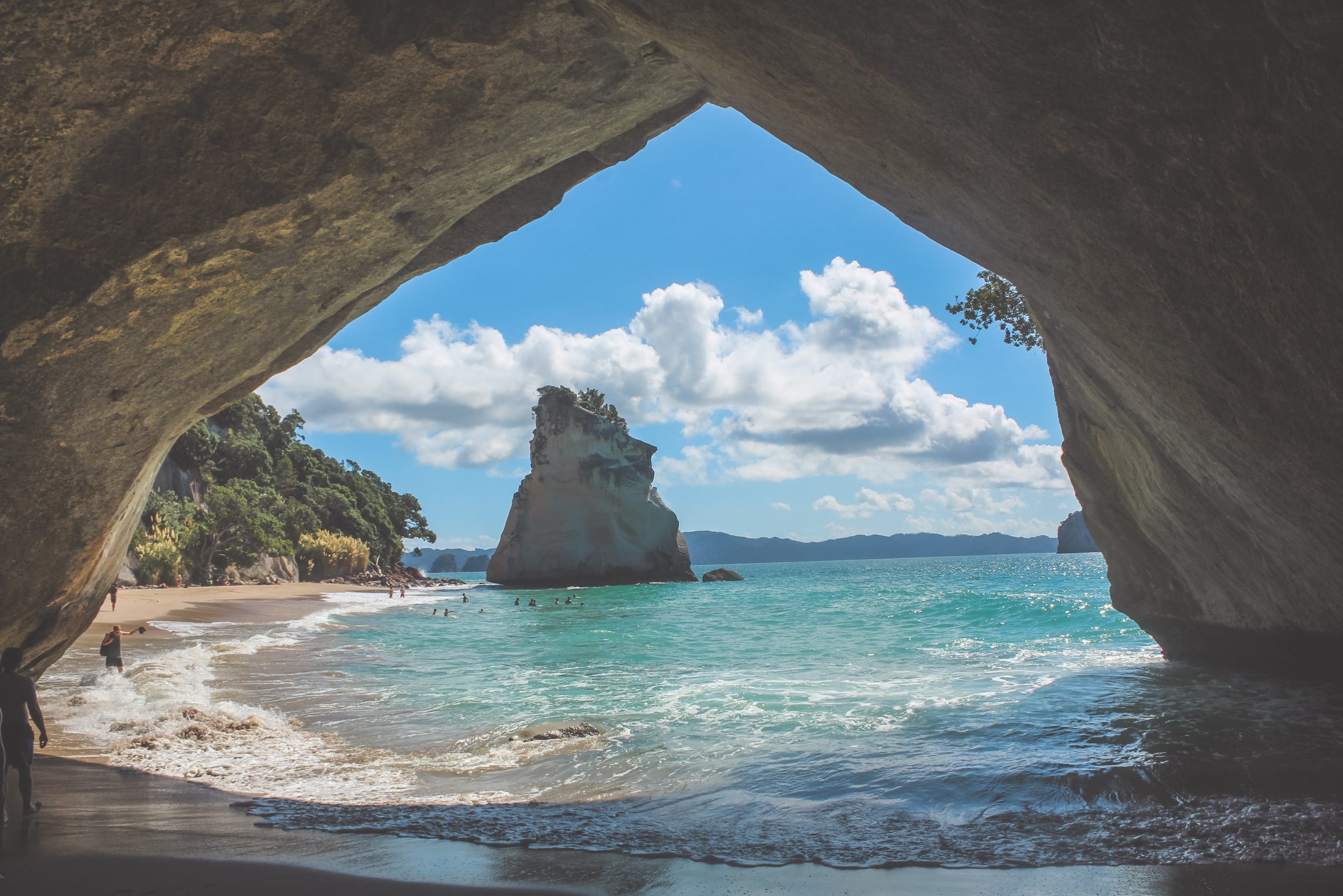
Length: 4.5km return
Time: 1h 35 min
Start point: Cathedral Cove Car Park
Walk highlights: This is another iconic New Zealand short walk to see the famous rock archway at Cathedral Cove. Expect dazzling views and a swimming opportunity once you reach the cove.
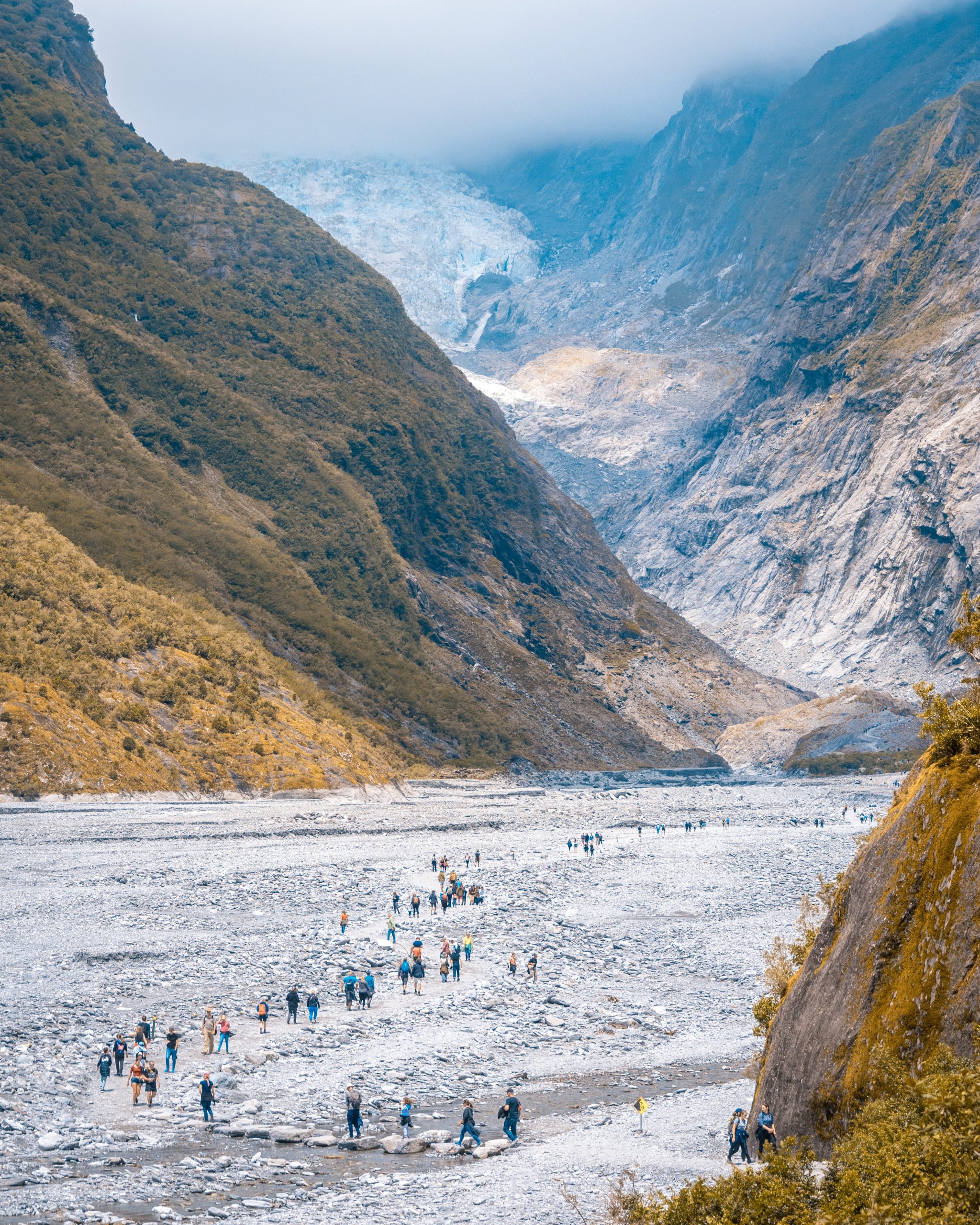
5. Tasman Glacier View Walk
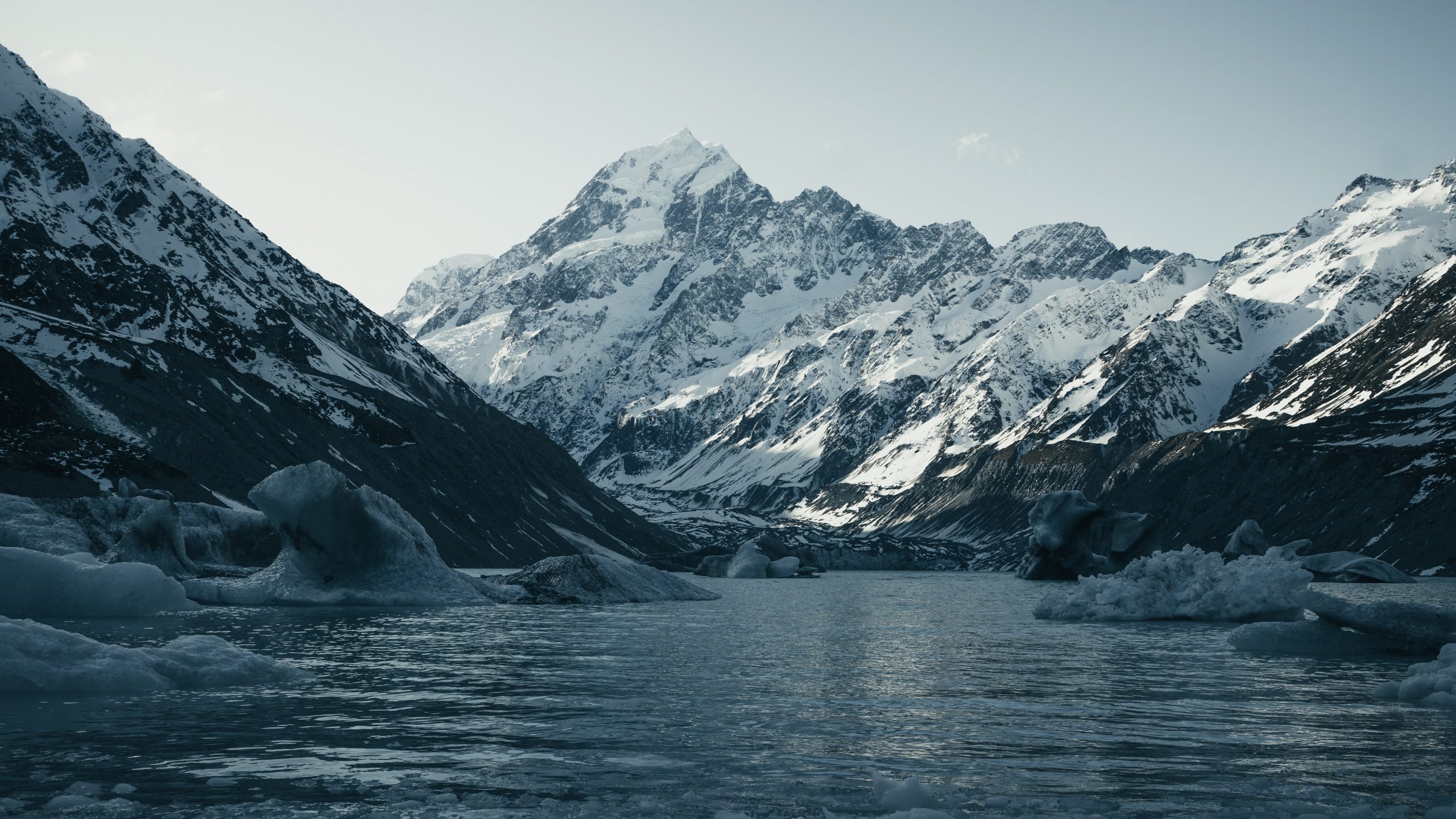
Length: 1.3km return
Time: 30 min
Start point: Tasman Glacier Car Park
Walk highlights: A short walk up steps to the Tasman Glacier Lookout. You’ll witness the icy cliffs of the glacier up close and the Tasman Lake beneath it. Don’t miss the dazzling Blue Pools on the way up!
6. Redwood Quarry Track (Rotorua)
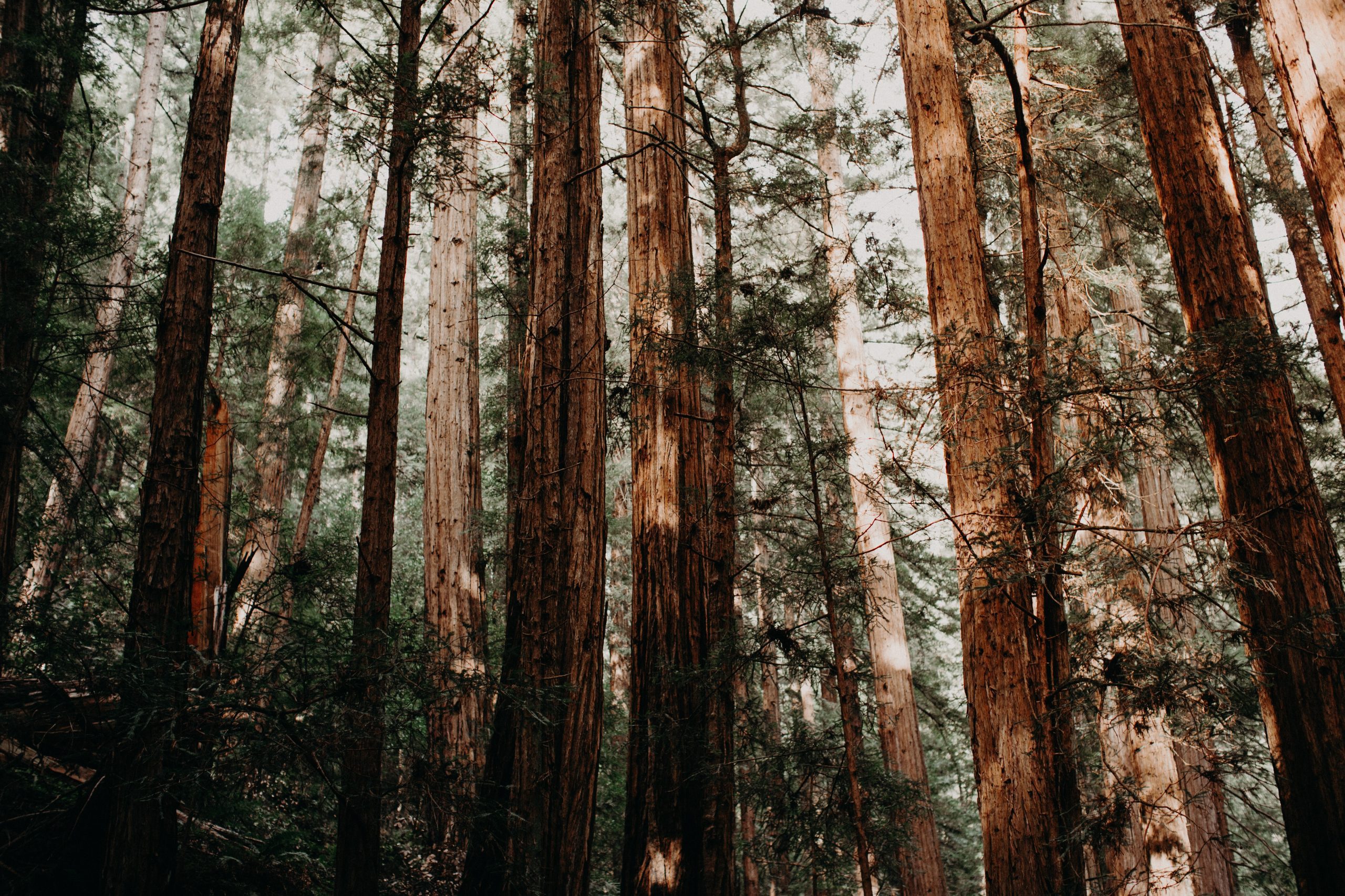
Length: 4.8km circular
Time: 1h 30 min
Start point: Redwoods i-SITE Visitor Information Centre
Walk highlights: A peaceful loop track through Rotorua’s Redwood Forest . You can do the Redwoods Treewalk for around $30 per person (alternatively this route is free if you’re happy to experience the redwoods from below).
7. Kaikoura Peninsula Walkway
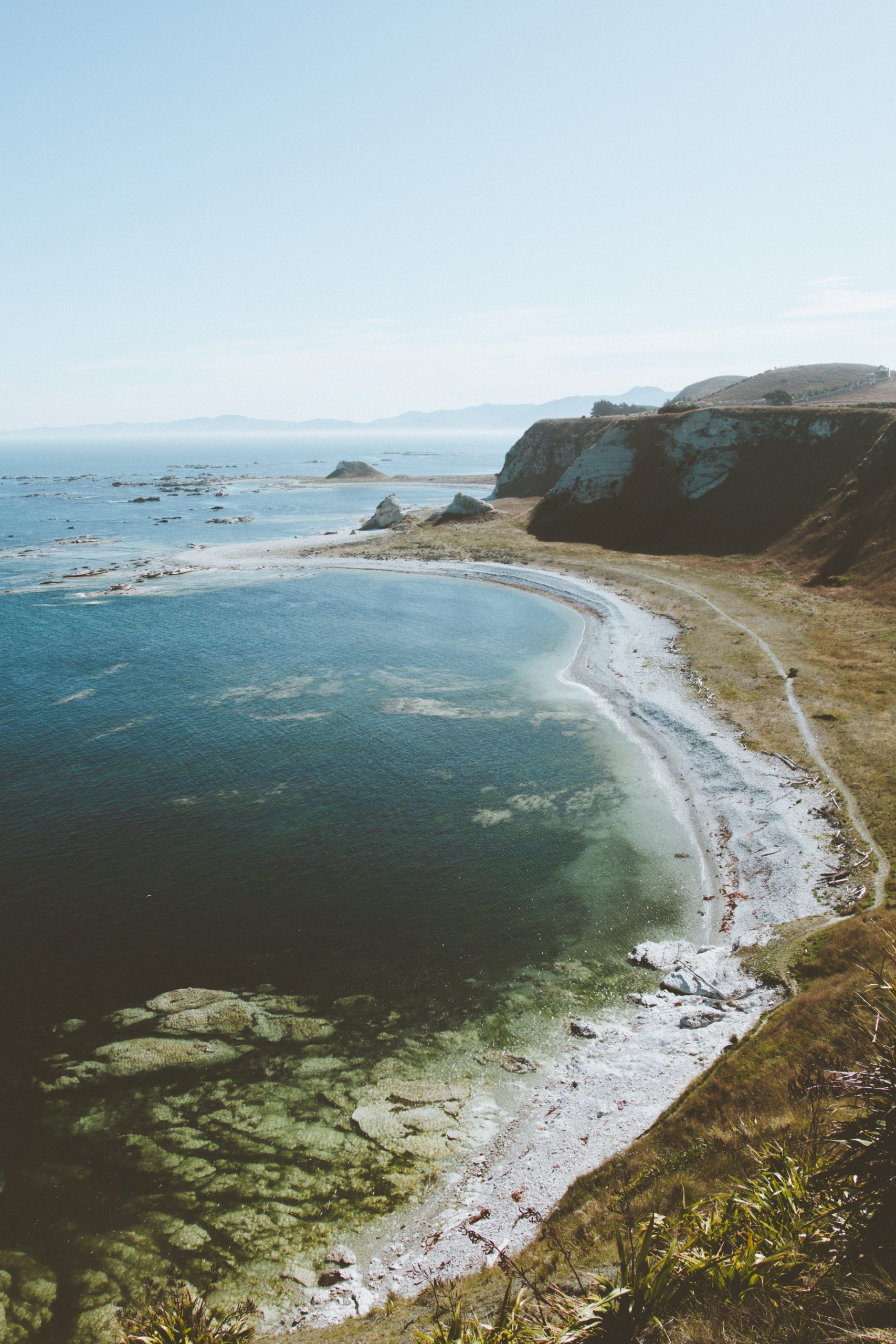
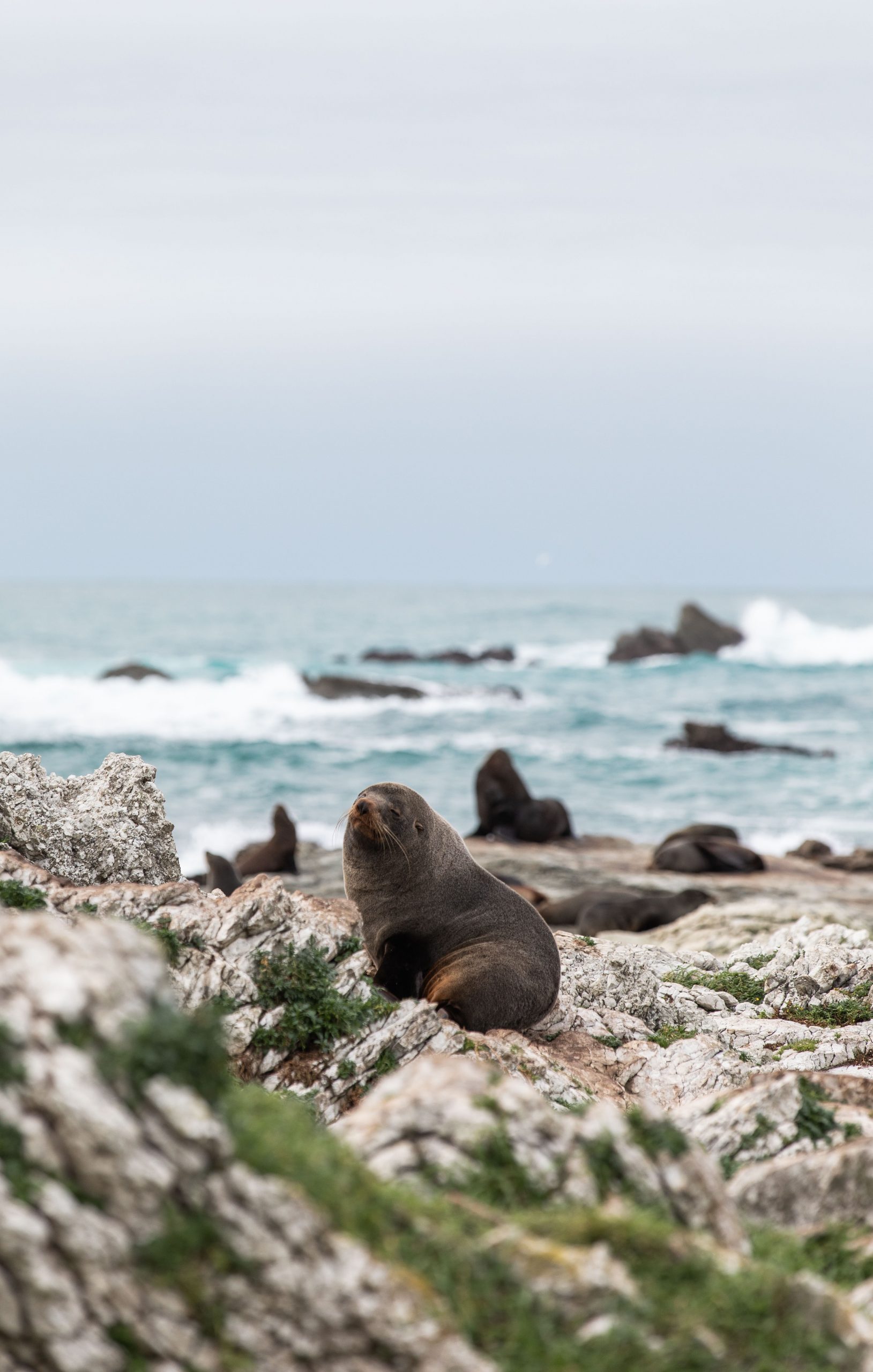
Length: 6.9km return
Time: 1h 45 min
Start point: Point Kean Viewpoint
Walk highlights: A relatively easy cliff-top walk, which hugs the coast line in Kaikoura. On the walk, you’ll be able to see New Zealand fur seals on the beach below. For a longer, circular route you can do the Kaikoura Peninsula Loop which starts in the centre of town.
8. Sealy Tarns Track
Length: 5.1km return
Time: 2h 50 min
Start point: White Horse Hill Campground
Walk highlights: One of my favourite walks in New Zealand! The Sealy Tarns Track is a challenging ascent up hundreds of steps to reach the Sealy Tarns Viewpoint. From here, you’ll have epic views of snow-capped Mt Cook and the glacial lakes from above.
9. Spa Park to Huka Falls Walk
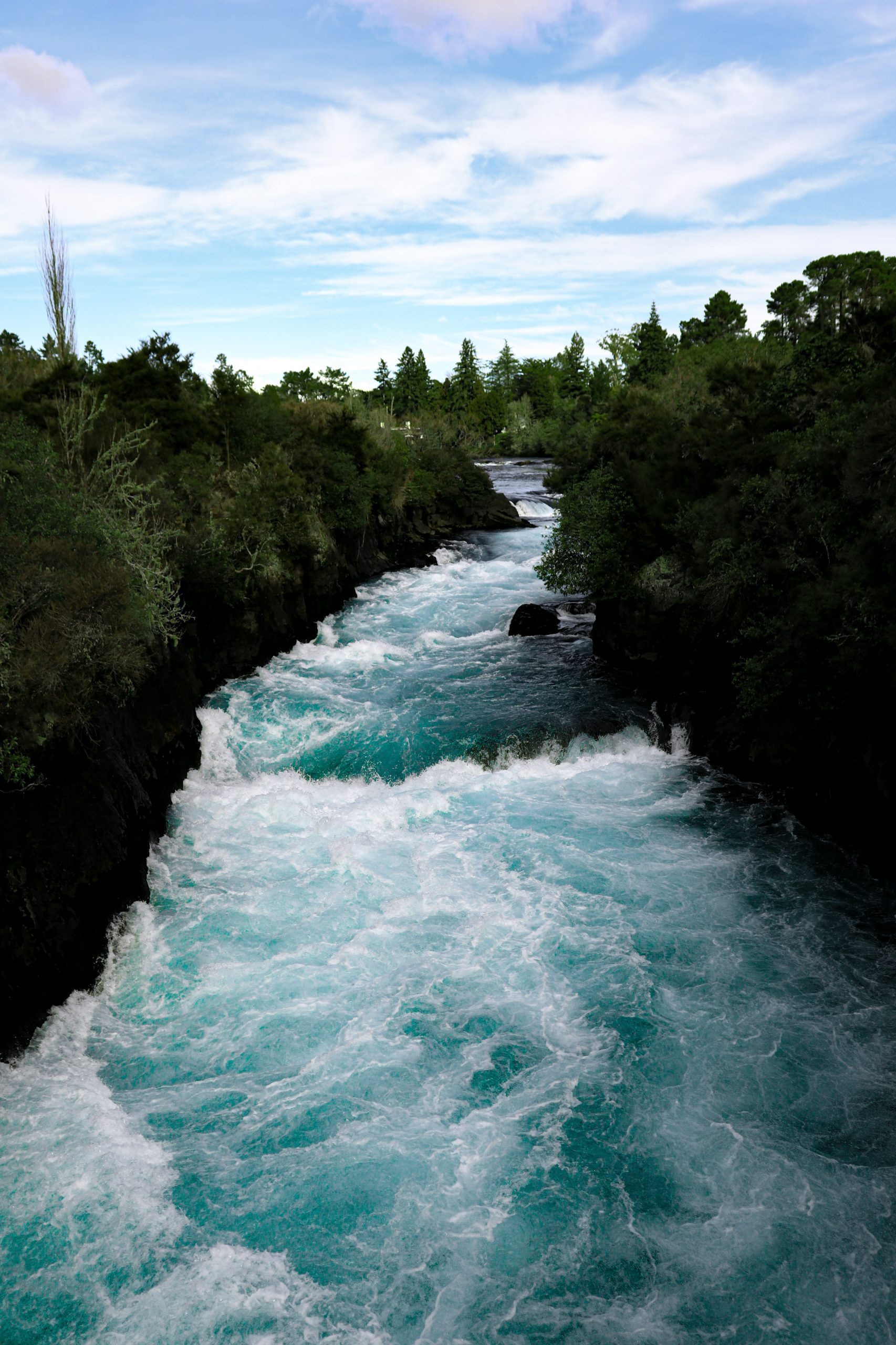
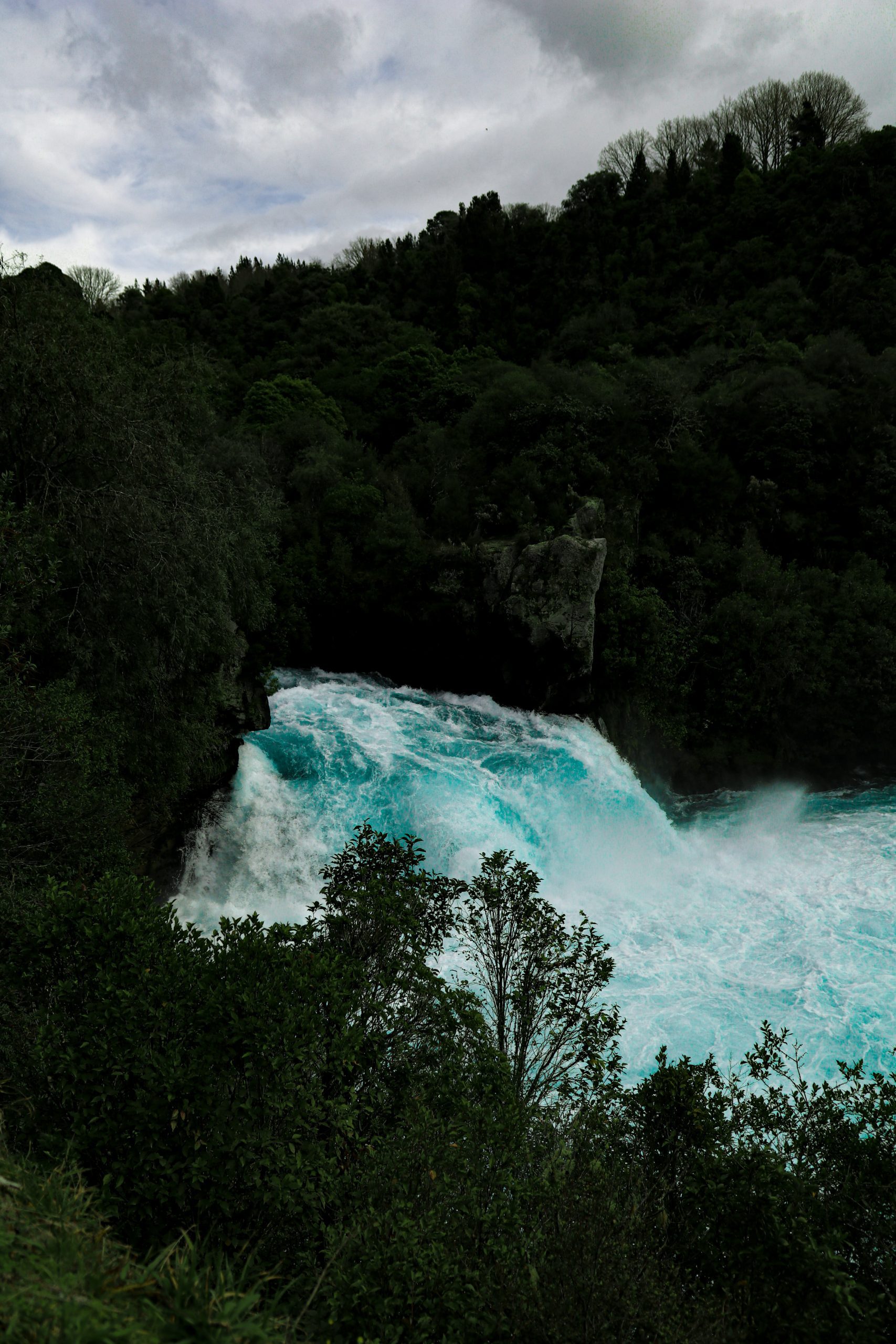
Length: 6.9km return
Time: 1h 50 min
Start point: Spa Park Car Park
Walk highlights: A moderate walk along the Waikato River to Huka Falls. As you walk by the side of the river, you can witness the flow of water getting faster and faster. By the time you reach the swing-bridge viewing platform, the river has turned into crashing rapids.
10. Franz Josef Glacier Track
Length: 1.4km return
Time: 20 min
Start point: Franz Josef Glacier Car Park
Walk highlights: A walk through the Franz Josef Glacier Valley, which ends at the glacier lookout. From here, you’ll be able to see the beauty of the retreating glacier and the rocky landscape left behind as the ice receeds.
11. Pitt Head Loop (Abel Tasman)
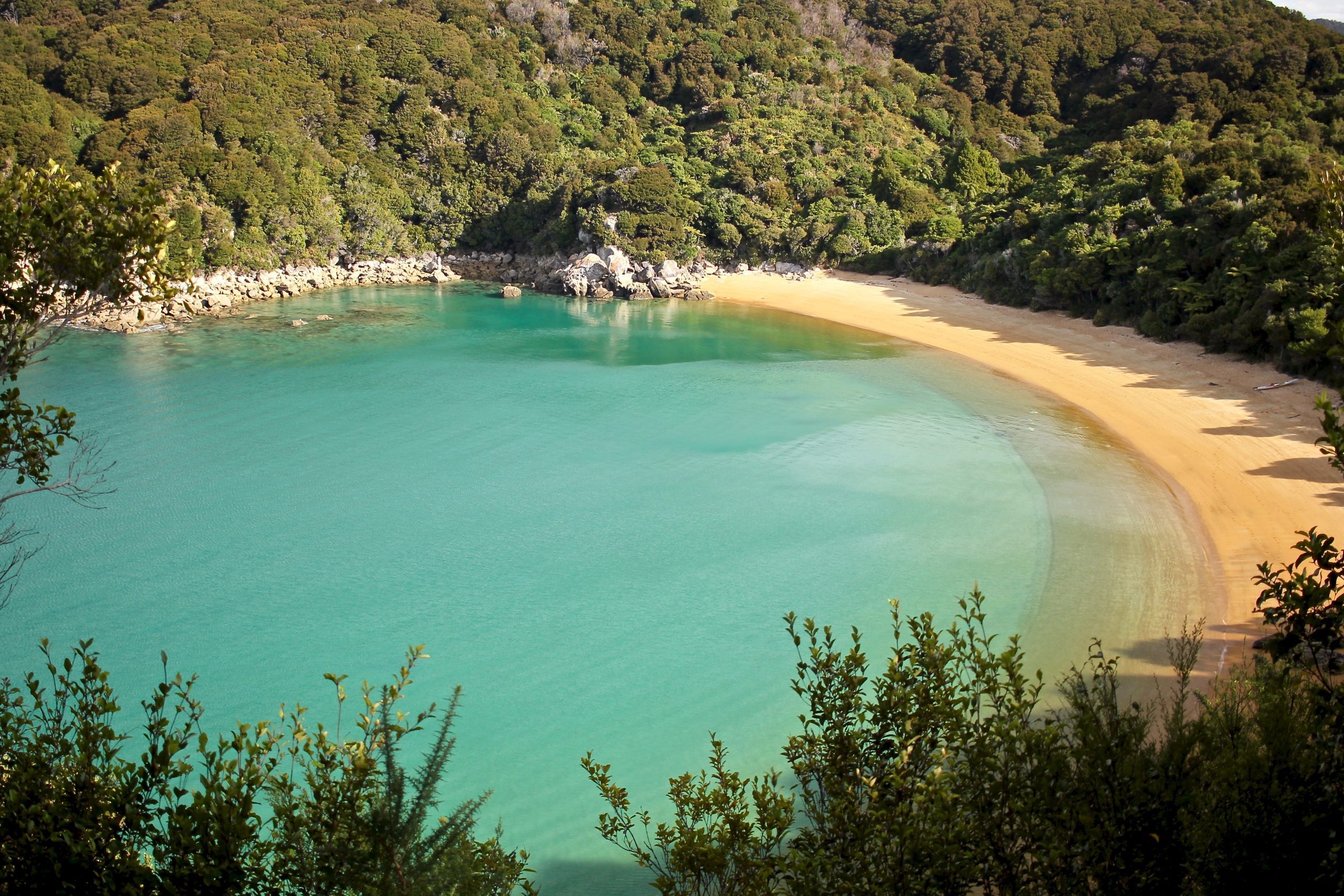
Length: 3.2km circular
Time: 55 min
Start point: Anchorage Bay Beach
Walk highlights: A gorgeous walk in the pristine Abel Tasman National Park, one of the most beautiful areas in the country. Walk through lush forest to the Pitt Head Lookout, offering views of golden sandy coves with aquamarine water. Don’t miss the view above Te Pukatea Bay, the most stunning beach in Abel Tasman. You will need to jump in a water taxi to reach the pristine but secluded Anchorage Bay (so worth it!).
12. Lake Pukaki Shoreline Walk
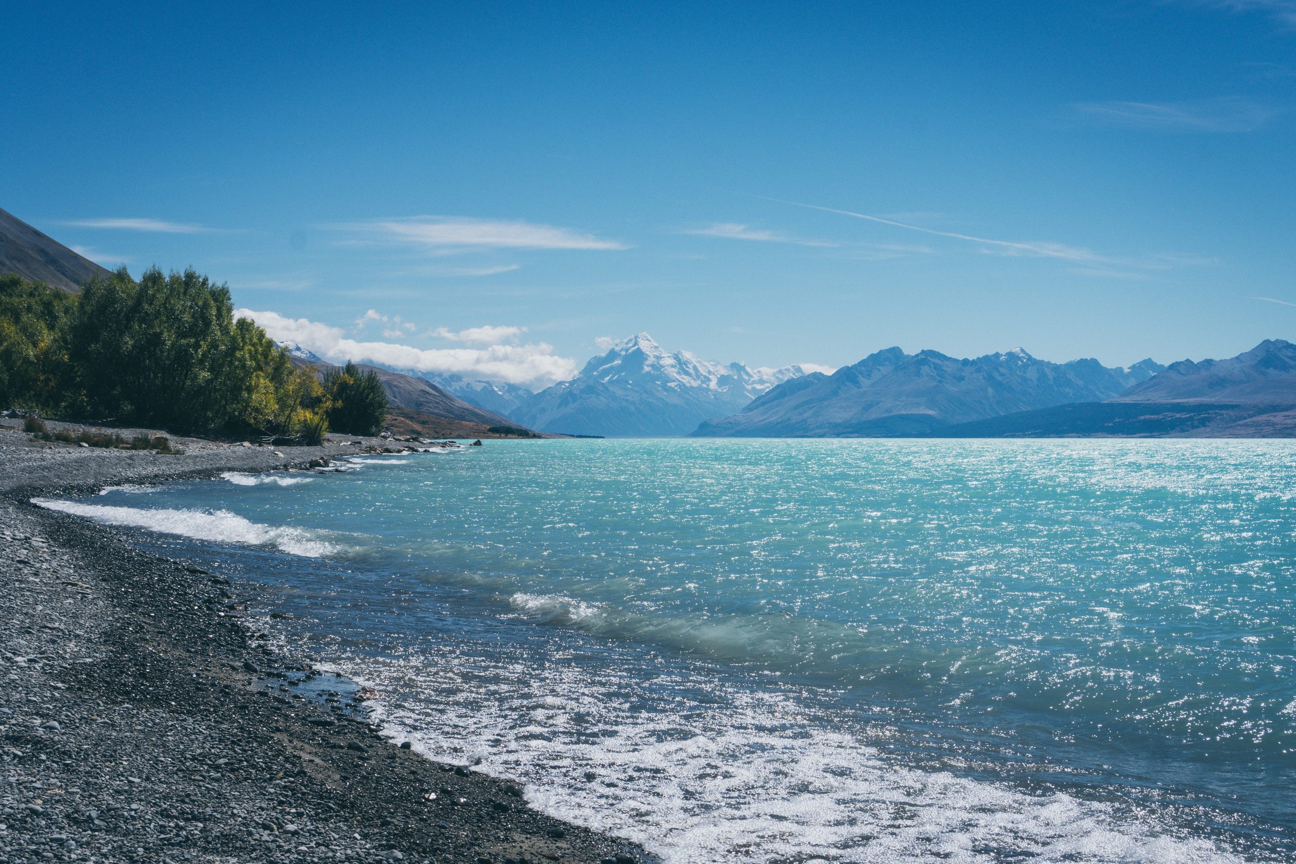
Length: As short or as long as you want! The entire track is 13km but you can do a short return section.
Time: 1h-4h
Start point: Lake Pukaki Car Park
Walk highlights: This foreshore walk hugs the southern end of Lake Pukaki and offers brilliant views across the turquoise water to Mt Cook Aoraki. The full track meanders for 13km, but you can just do a short section before returning to your car/ campervan if you wish.
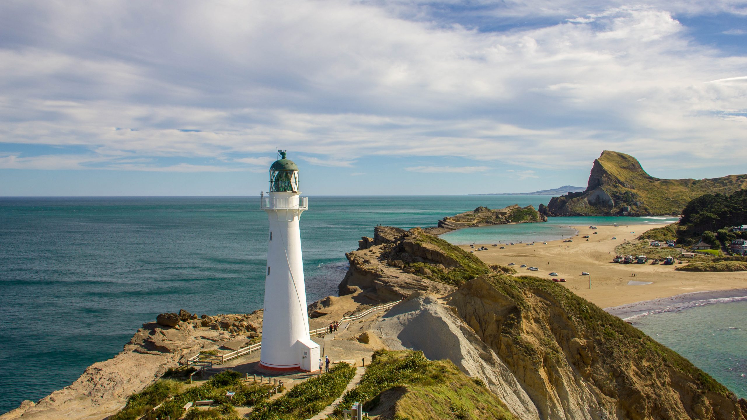
13. Cape Reinga Lighthouse Trail
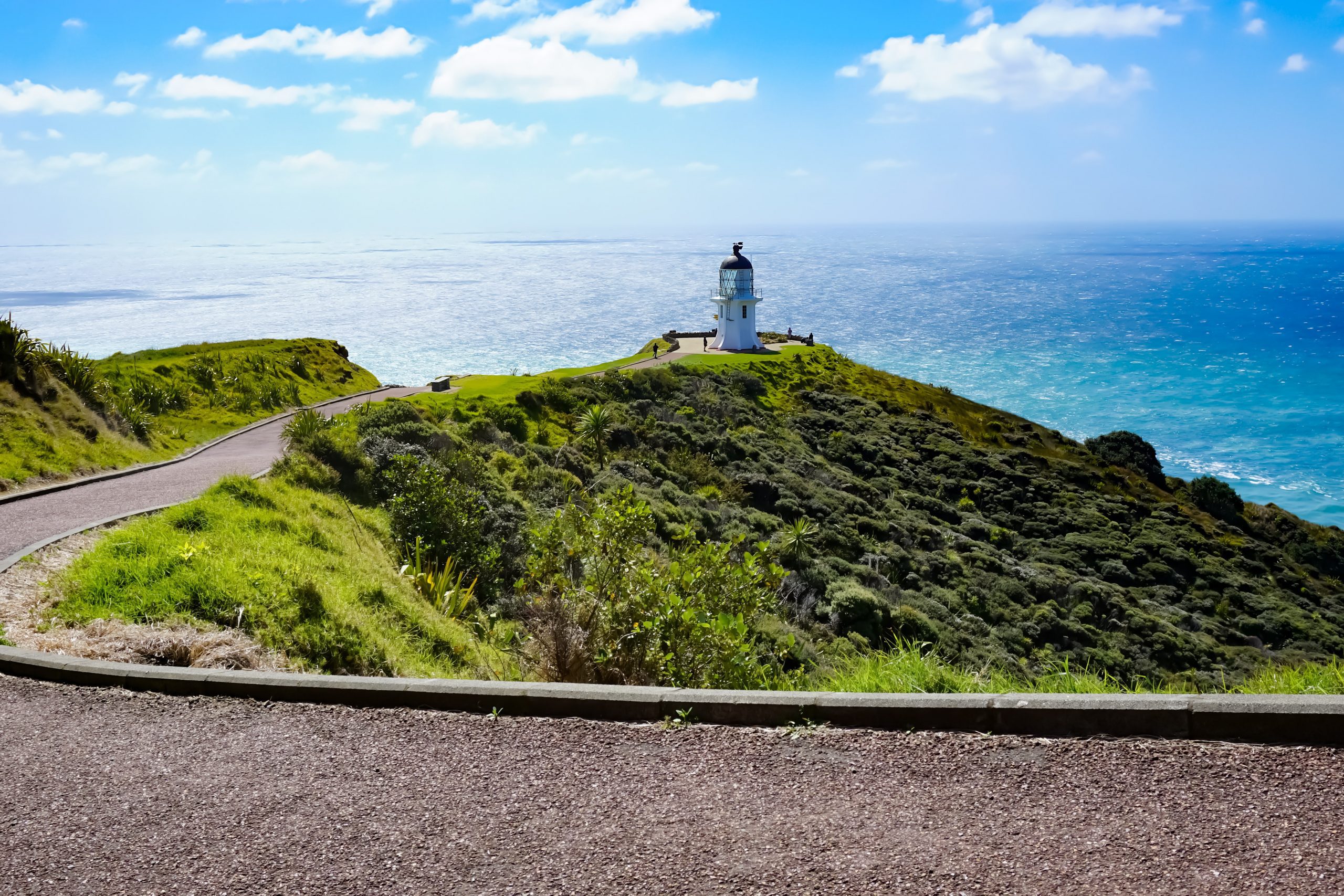
Length: 1.6km return
Time: 35 min
Start point: Cape Reinga Parking Area
Walk highlights: A leisurely short stroll to the Cape Reinga Lighthouse, the most northerly tip of New Zealand. From here, you can witness the Tasman Sea and the Pacific Ocean collide, which creates interesting currents in the water.
14. Wilkies Pools Loop Track (Mt Taranaki)
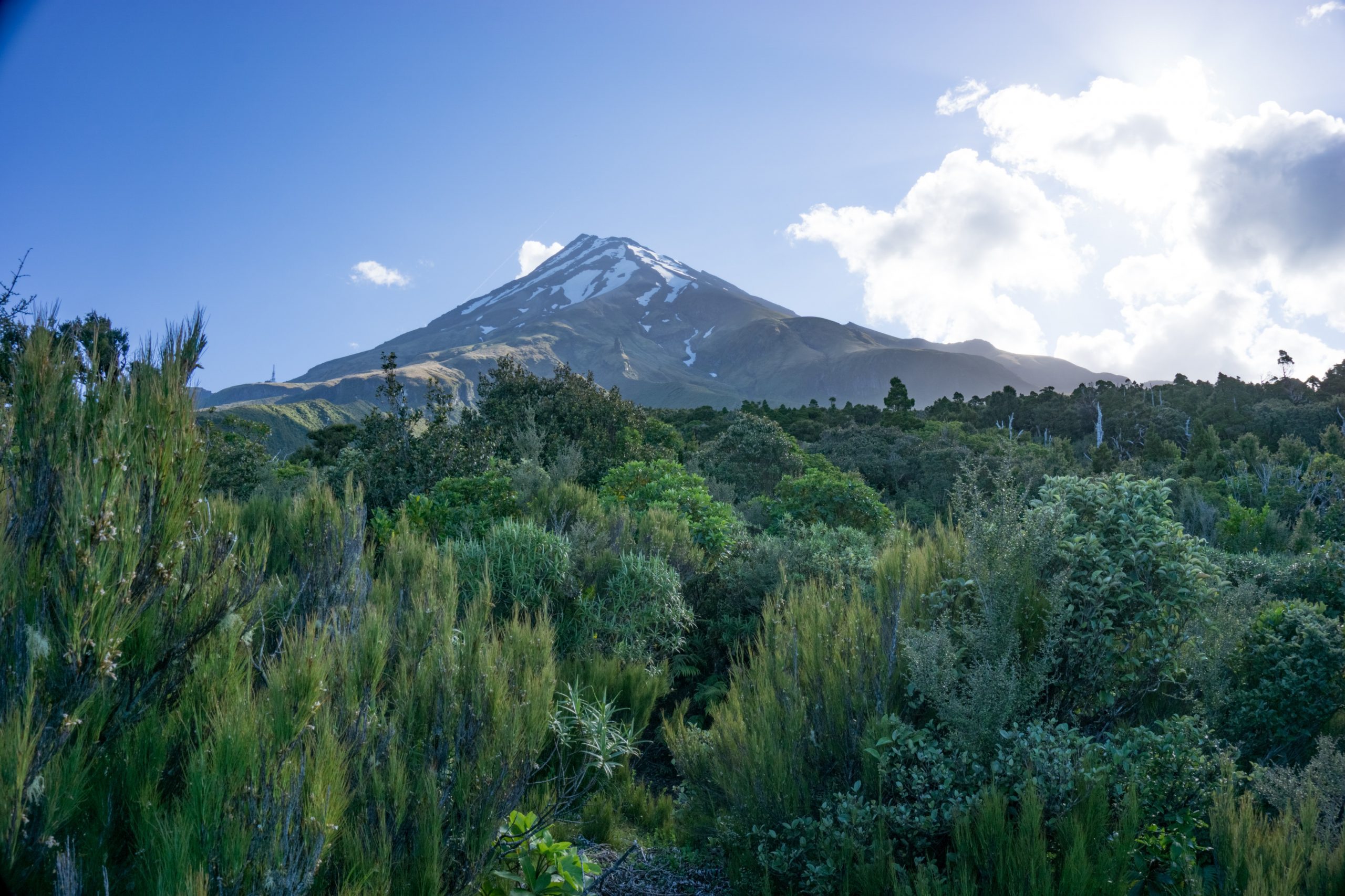
Length: 2.6km circular
Time: 1h 5 min
Start point: DOC Visitor Centre Dawson Falls
Walk highlights: A leisurely walk to clear pools, offering stunning views of Mount Taranaki. Enjoy the calming sounds of the water running by as you take in the nature around you.
15. Lake Matheson Loop Trail
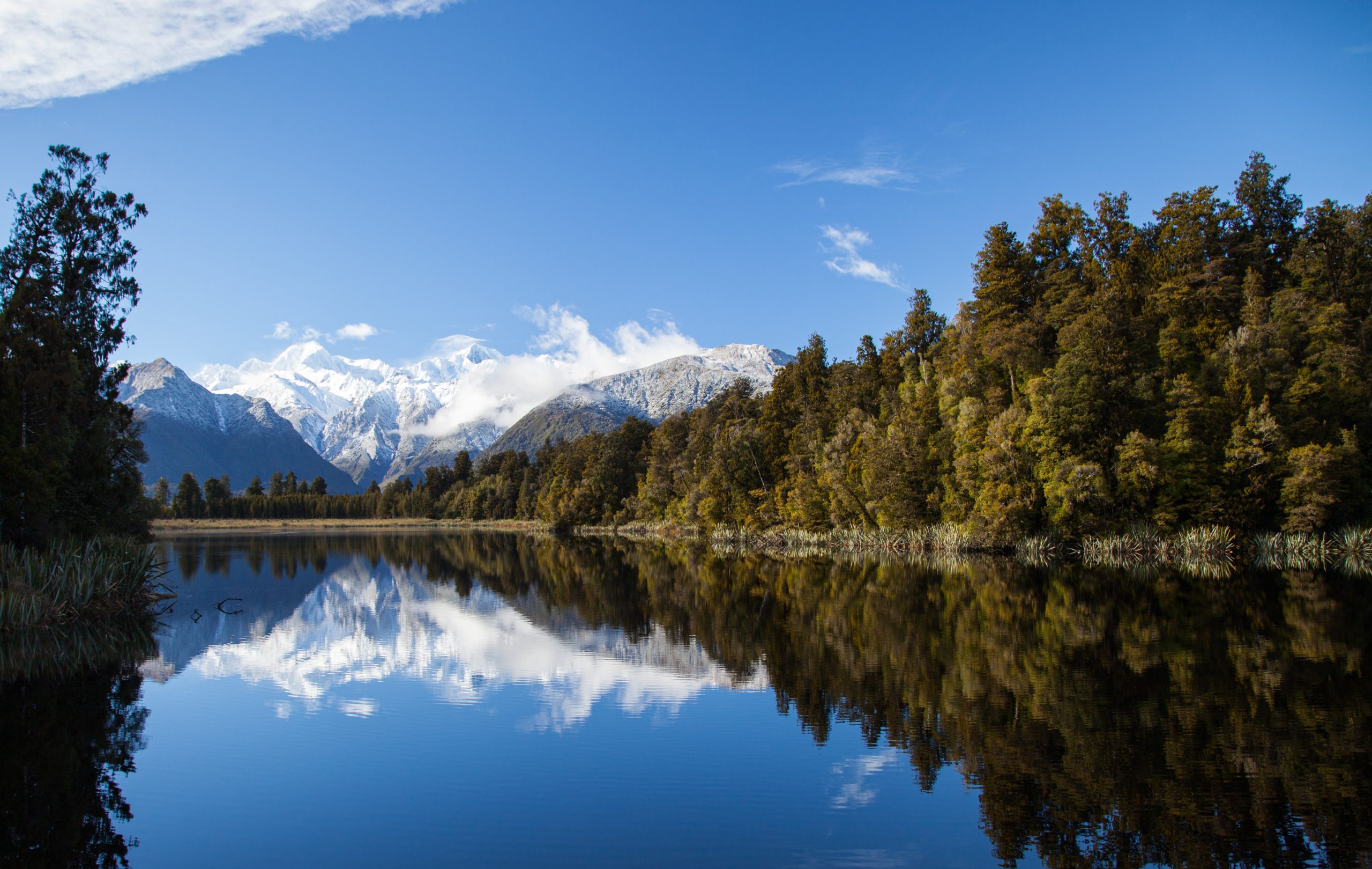
Length: 4.3km circular
Time: 1h 10 min
Start point: Lake Matheson Parking
Walk highlights: A chilled walk around Lake Matheson in Glacier Country. The glassy lake is flanked by snow-capped mountains and there are a couple of lovely jetty viewpoints to stop at and take in your surroundings.
16. Waiheke Island Short Loop
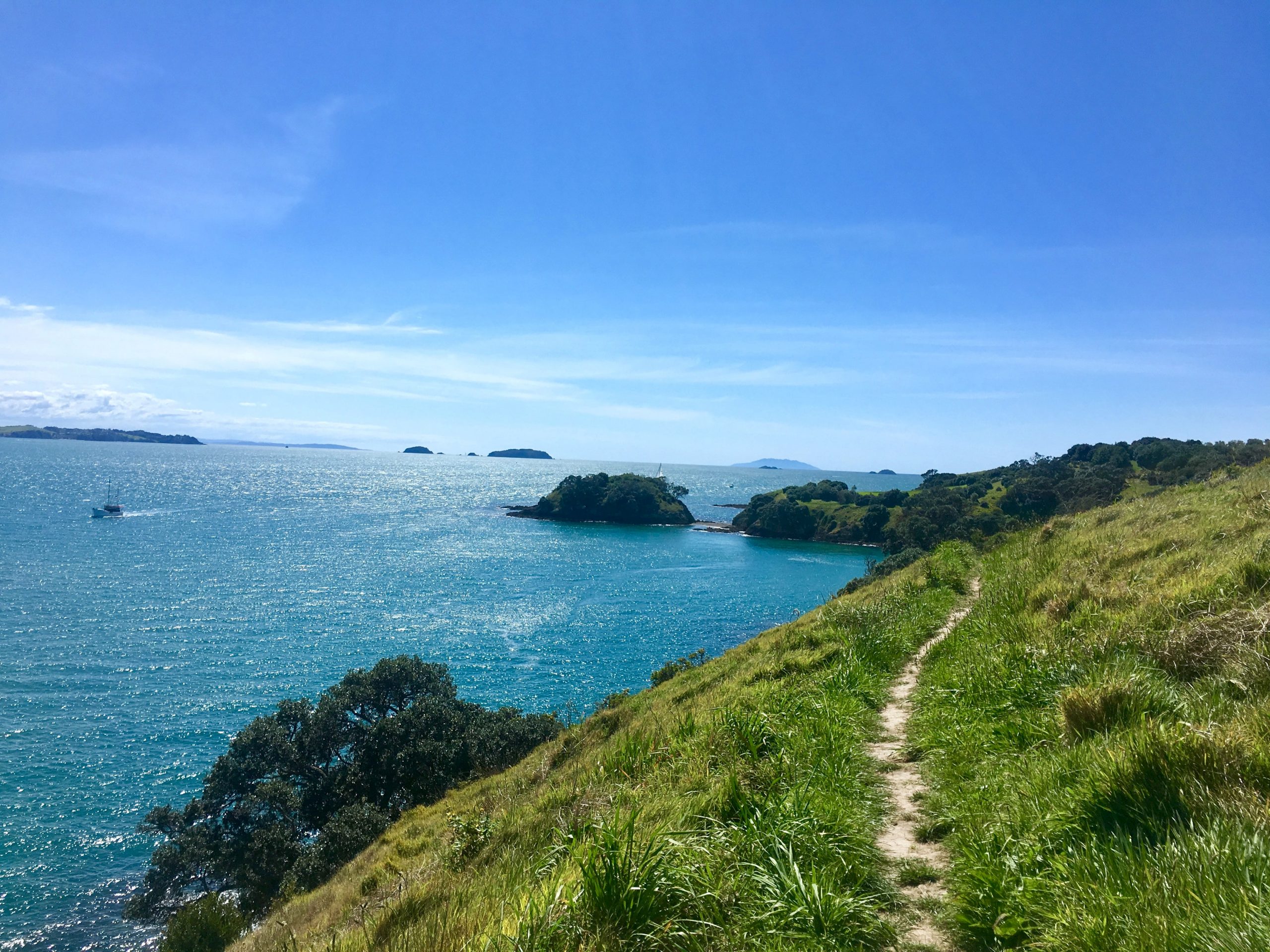
Length: 5.5km circular
Time: 1h 30 min
Start point: Waiheke Island Ferry Terminal
Walk highlights: A wonderful moderate loop around the north-west section of Waiheke Island. The walk takes you through lush hills before arriving at Owhanake Beach and hugging the coastline past idyllic bays and headlands.
17. Mt John Circuit Summit Track (Lake Tekapo)
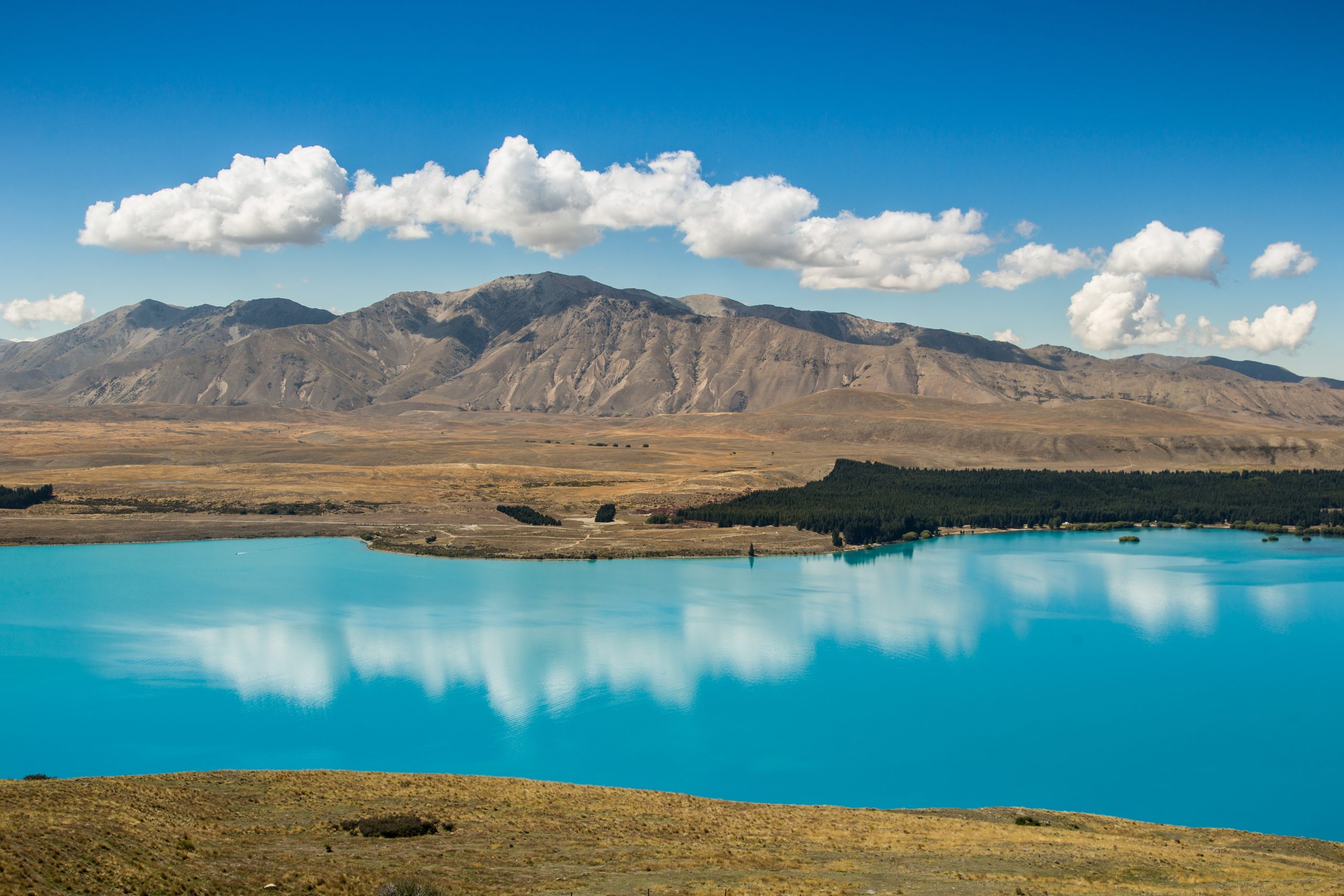
Length: 8km circular
Time: 2h 45 min
Start point: Tekapo Springs Car Park
Walk highlights: A relatively challenging uphill ascent to the Mt John Observatory Viewpoint, an astrology research facility owned by the University of Canterbury. From the summit, you’ll witness the bright blue waters of Lake Tekapo from above, and great views of the Southern Alps mountain range in the opposite direction.
18. Mount Maunganui Track
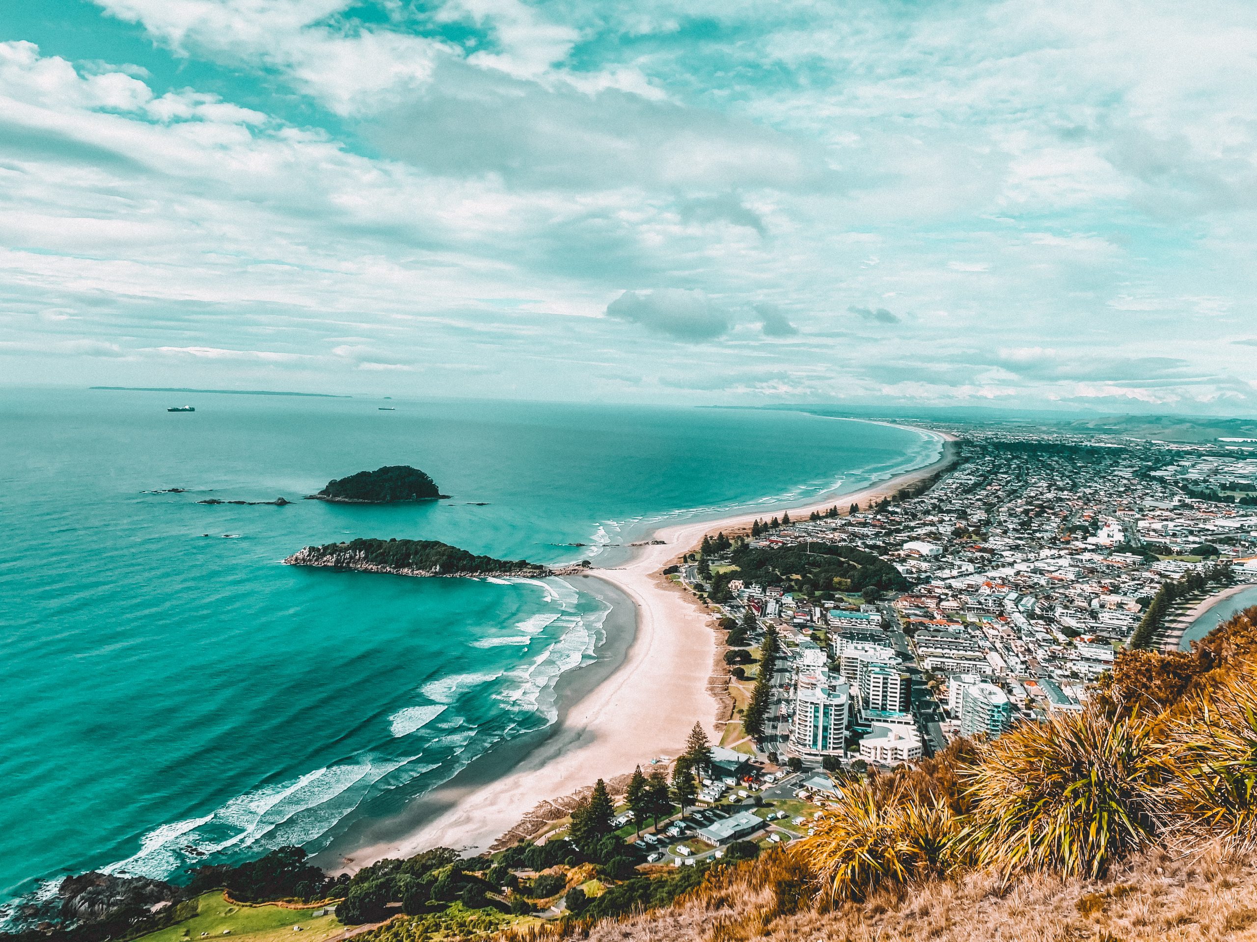
Length: 6.4km circular
Time: 2h
Start point: At the north end of Maunganui Beach by the holiday park
Walk highlights: A moderately challenging ascent up an extinct volcano, offering breathtaking views of the Bay of Plenty from the summit.
19. Queenstown Hill Walkway
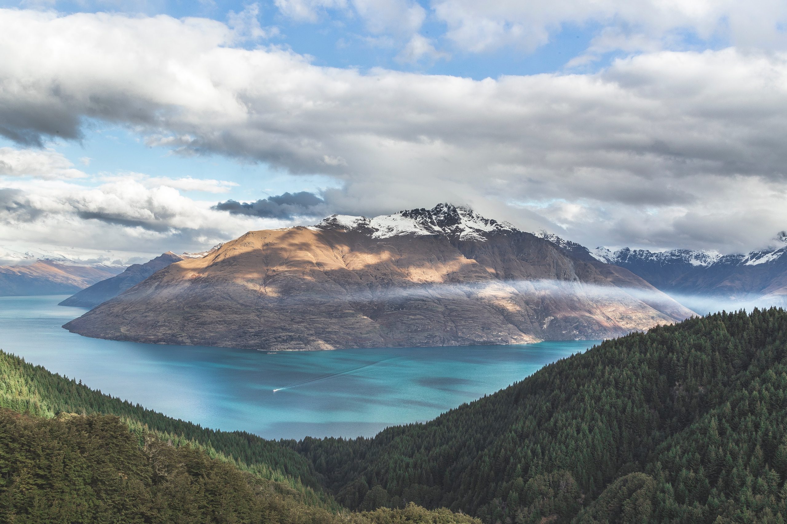
Length: 4.8km return
Time: 2h 15 min
Start point: Belfast Terrace
Walk highlights: A semi-difficult uphill ascent to the summit of Queenstown Hill (which is actually a small mountain!). You’ll ascend through pine forest before reaching a lookout with views over Lake Wakatipu and The Remarkables mountain range.
20. Hokitika Gorge Walk
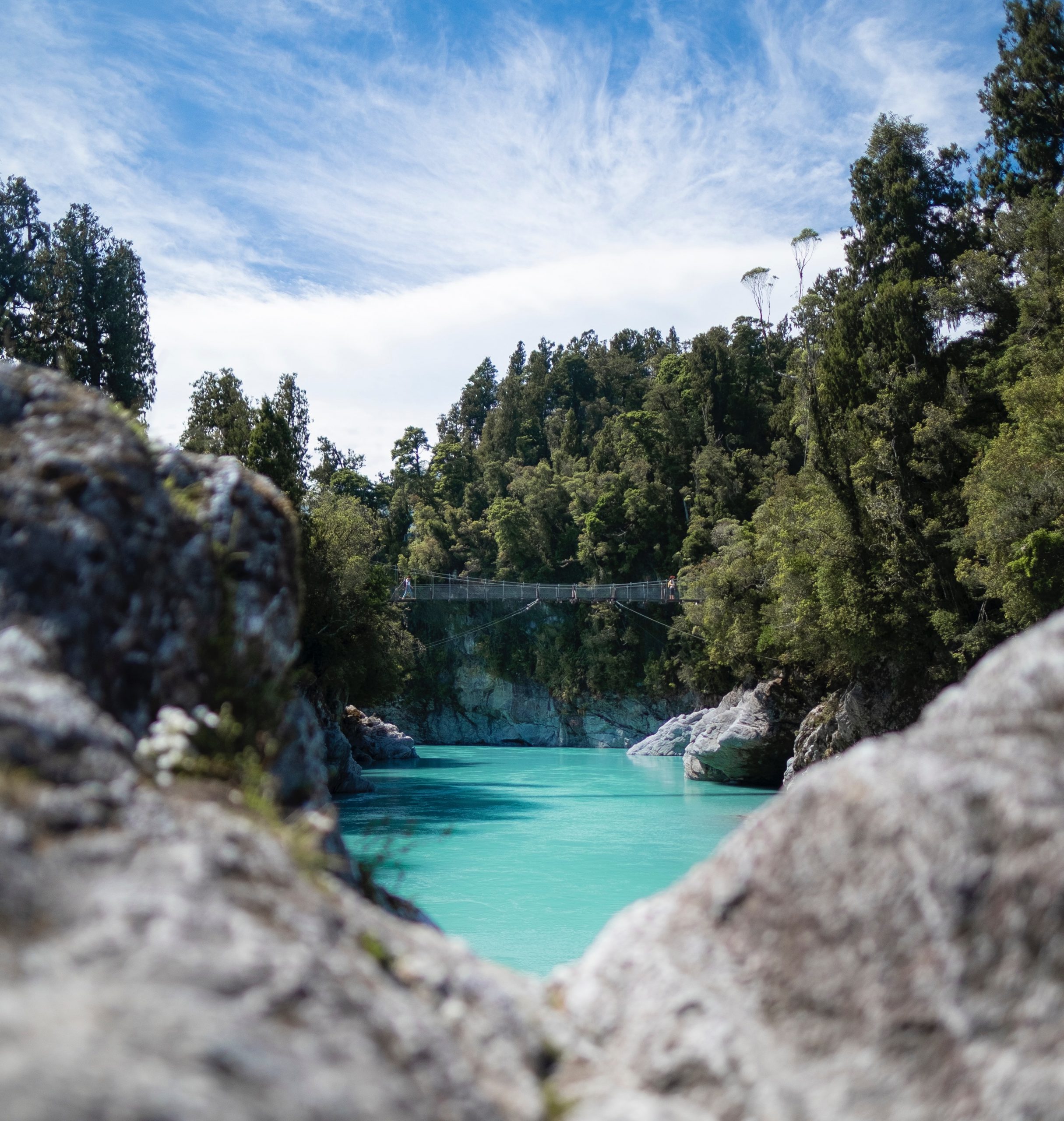
Length: 2.1km circular
Time: 35 min
Start point: Hokitika Gorge Parking
Walk highlights: A leisurely walk to Hokitika Gorge over swing-bridges, arguably the bluest water in New Zealand! The gorge was ground out of granite by the Hokitika River, and it has a bright milky turquoise colour.
21. Onahau Lookout Track (Marlborough Sounds)
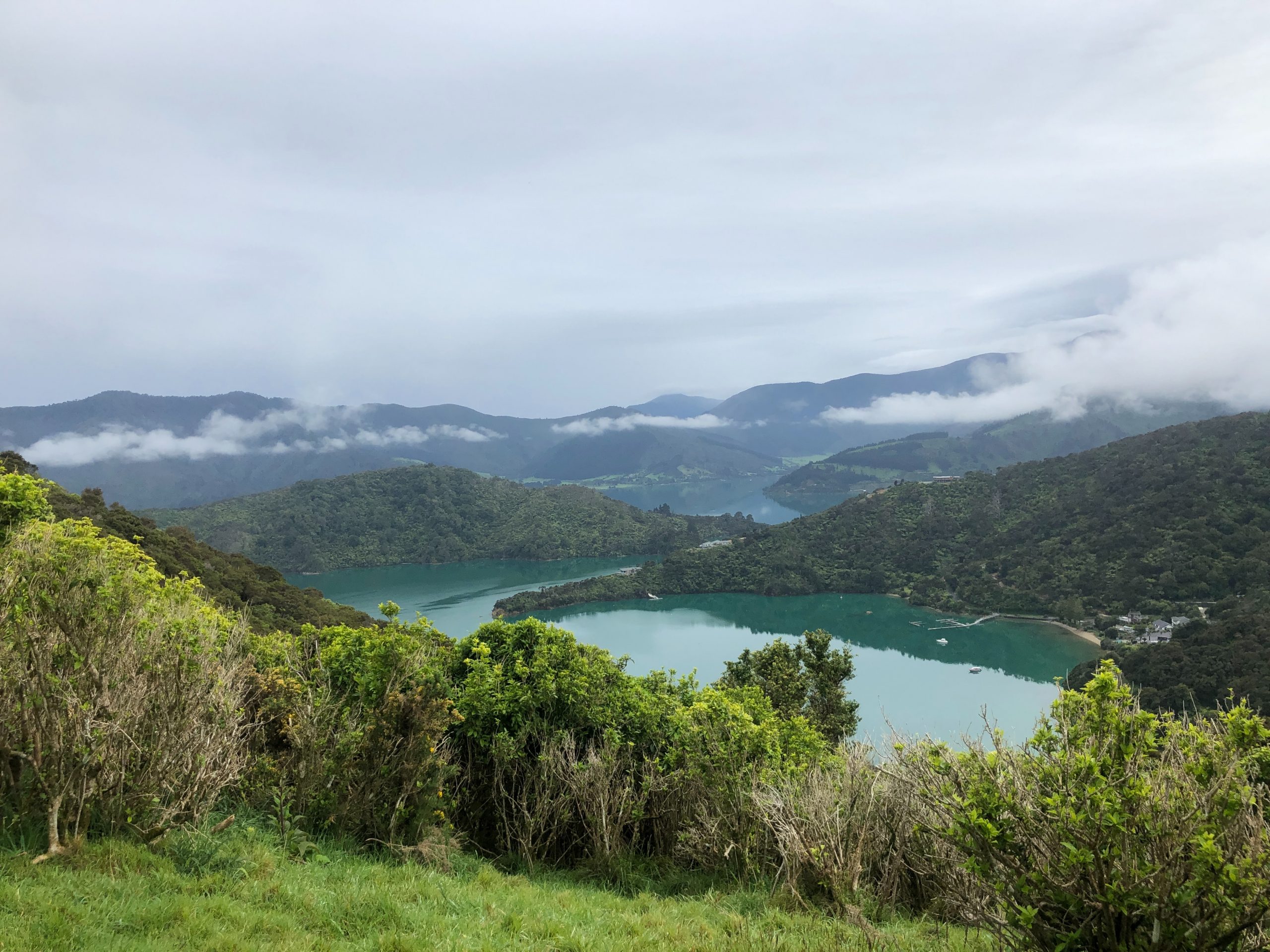
Length: 3.7km circular
Time: 1h 40 min
Start point: The end of Onahau Road
Walk highlights: This short but steep tramp takes you to the Onahau Lookout, where you’ll be rewarded with stunning views of the Marlborough Sounds.
22. The Outlet Track (Lake Wanaka)
Length: 12.1km point-to-point
Time: 2h 45 min
Start point: Lake Wanaka Centre (Waterfront)
Walk highlights: A great one-way walk from Wanaka to Albert Town. As you walk, the lake turns into the Clutha River, which is a lovely clear blue colour.
23. Rangitoto Summit Track (Auckland)
Length: 5.5km return
Time: 1h 45 min
Start point: Rangitoto Wharf
Walk highlights: A moderate hike on the volcanic Rangitoto Island, just off Auckland. The return track through black rock ascends gently to the summit, offering panoramic views of the gulf.
24. Mount Tauhara Track (Lake Taupo)
Length: 6.6km return
Time: 3h
Start point: The end of Mountain Road
Walk highlights: A challenging leg-burner to the summit of Mount Tauhara. From the top, you’ll be rewarded with panoramic views over Lake Taupo and central North Island.
25. Mount Victoria Lookout
Length: 2.4km circular
Time: 50 min
Start point: Lawson Place, Mount Victoria
Walk highlights: An easy walk from Charles Plimmer Park to the Mount Victoria Lookout. From the top, you’ll be able to see panoramic views of Wellington, the wharf and the mountains beyond.
26. Christchurch Adventure Park Walking Track
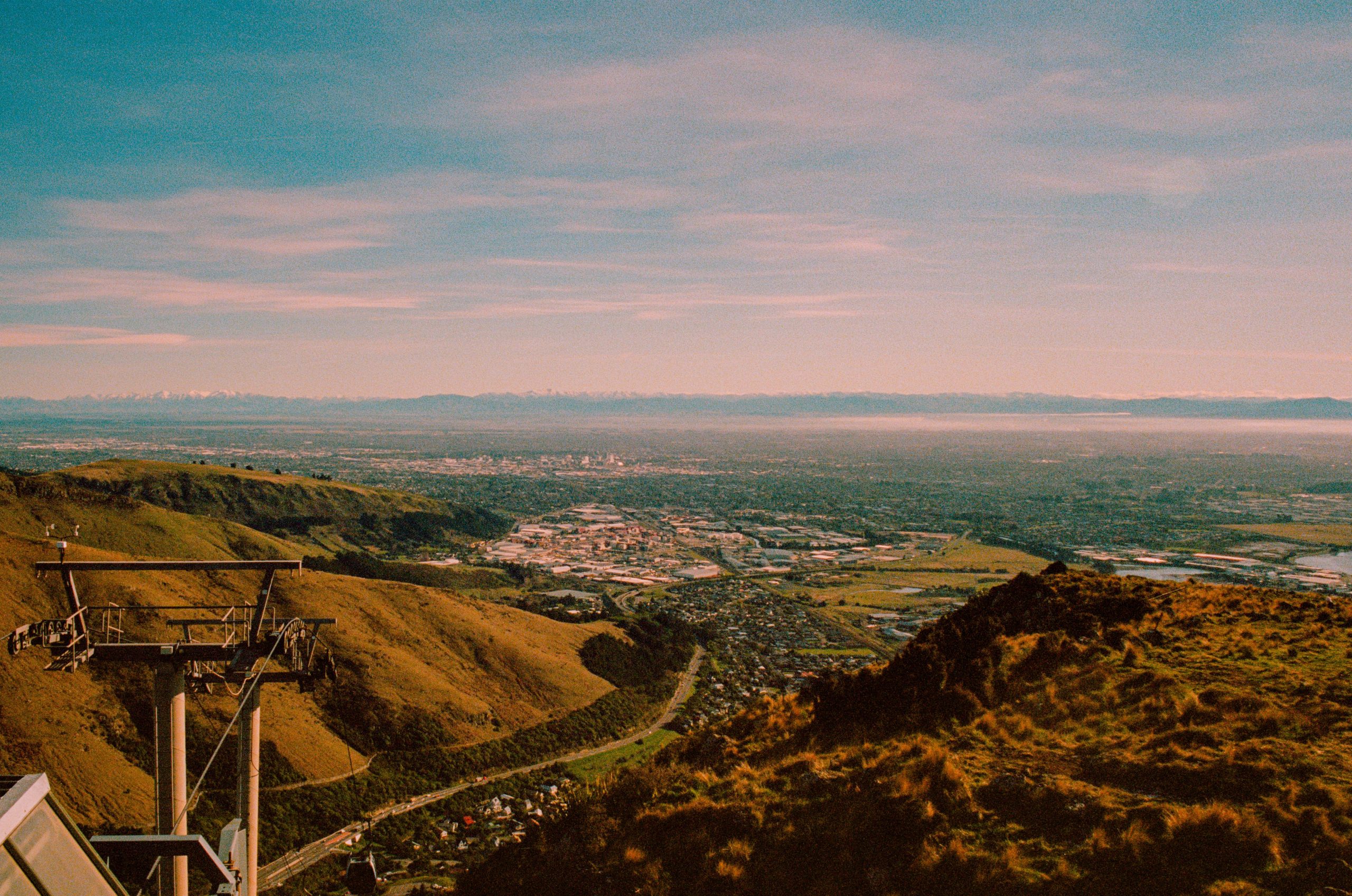
Length: 5.3km one way (get chairlift back)
Time: 1h 45 min
Start point: Christchurch Adventure Park Car Park
Walk highlights: This is a lovely walk just 15 minutes outside of Christchurch city. You can take the uphill track through woodland and fields to the chairlift top station. From here, you’ll have a great vantage point over Christchurch and Lyttelton Harbour, before descending back to the car park on the chairlift.
27. Glenorchy Lagoon Scenic Walkway
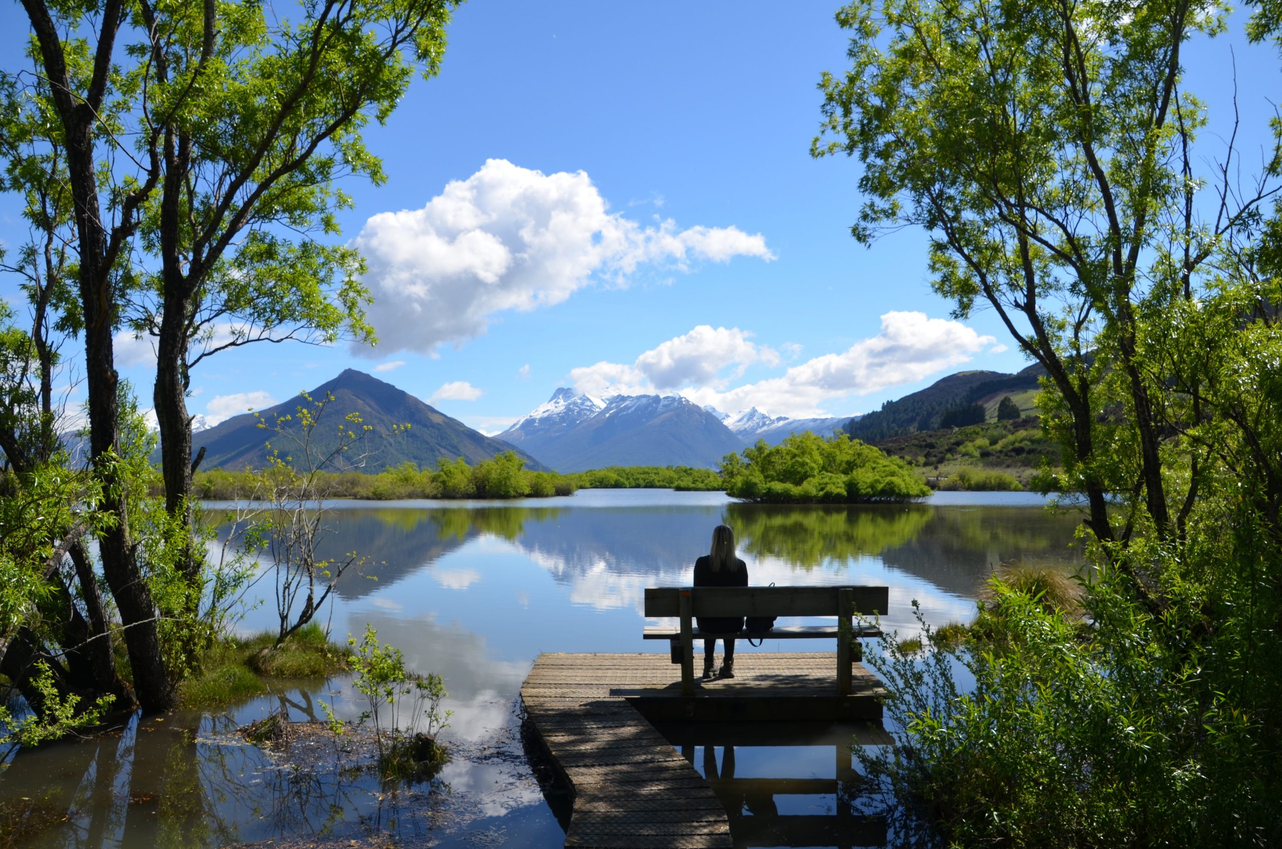
Length: 3.4km circular
Time: 45 min
Start point: Glenorchy Waterfront Car Park
Walk highlights: A family-friendly long boardwalk, which meanders through lush green wetlands and brings you out at the Glenorchy Lagoon. On a clear day you’ll see great views of the snow-capped mountains across the water. There are wooden benches dotted around the walkway – a great spot for a picnic with the kids.
28. Sawpit Gully Track (Arrowtown)
Length: 7.7km circular
Time: 2h 45 min
Start point: Buckingham Street Car Park
Walk highlights: A great walk in the hills above the old gold mining settlement of Arrowtown. You’ll walk past rivers, pine forests and snow-capped mountains. The walk is especially beautiful in the autumn, when the pine trees become a carpet of reds and golds.
29. Kura-Tawhiti Access Track
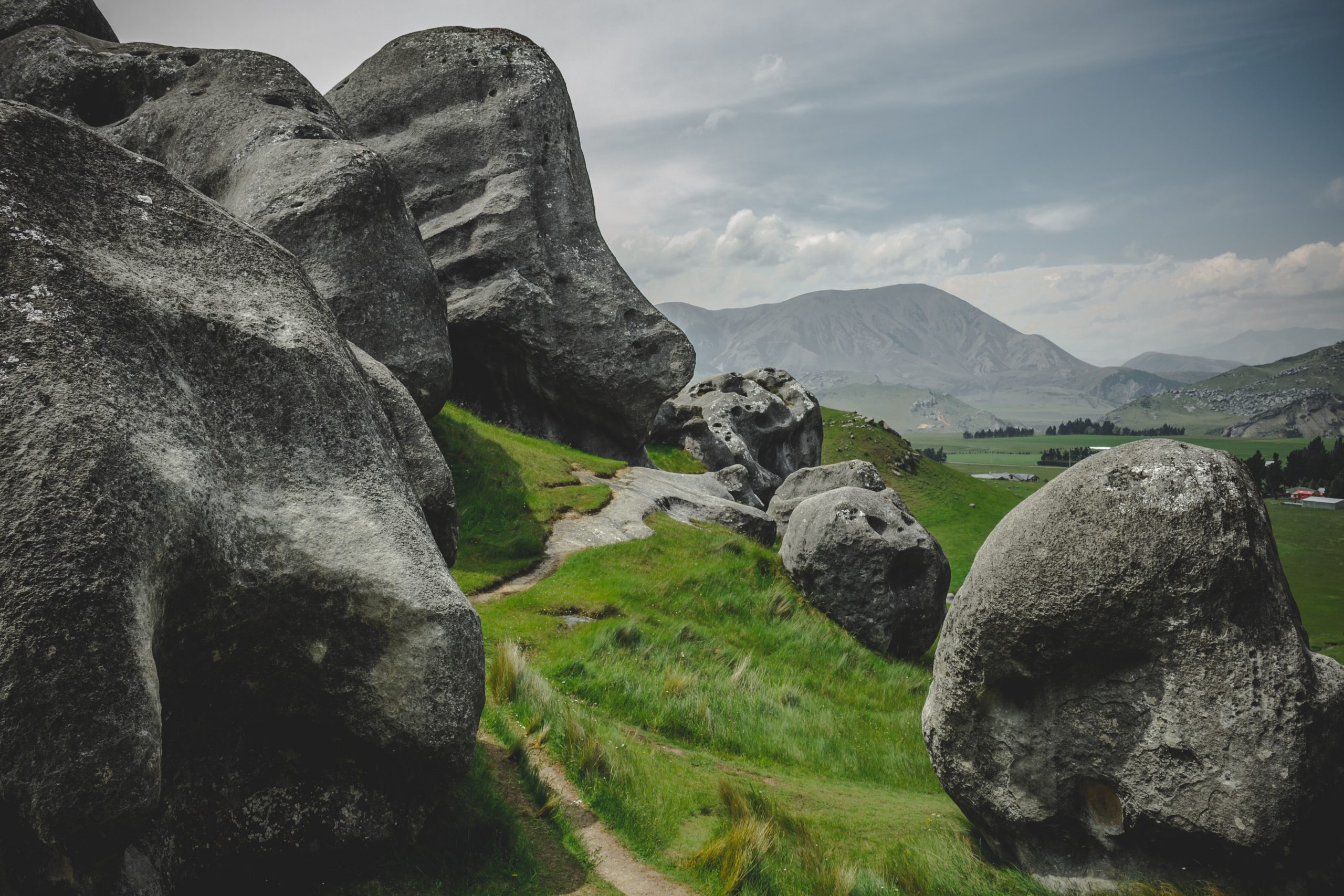
Length: 5km circular
Time: 1h 45 min
Start point: Castle Hill Car Park
Walk highlights: A short walk to the top of Castle Hill, where you can enjoy large giant rock formations and views of the snow-capped Southern Alps.
30. Devil’s Punchbowl Lookout Trail
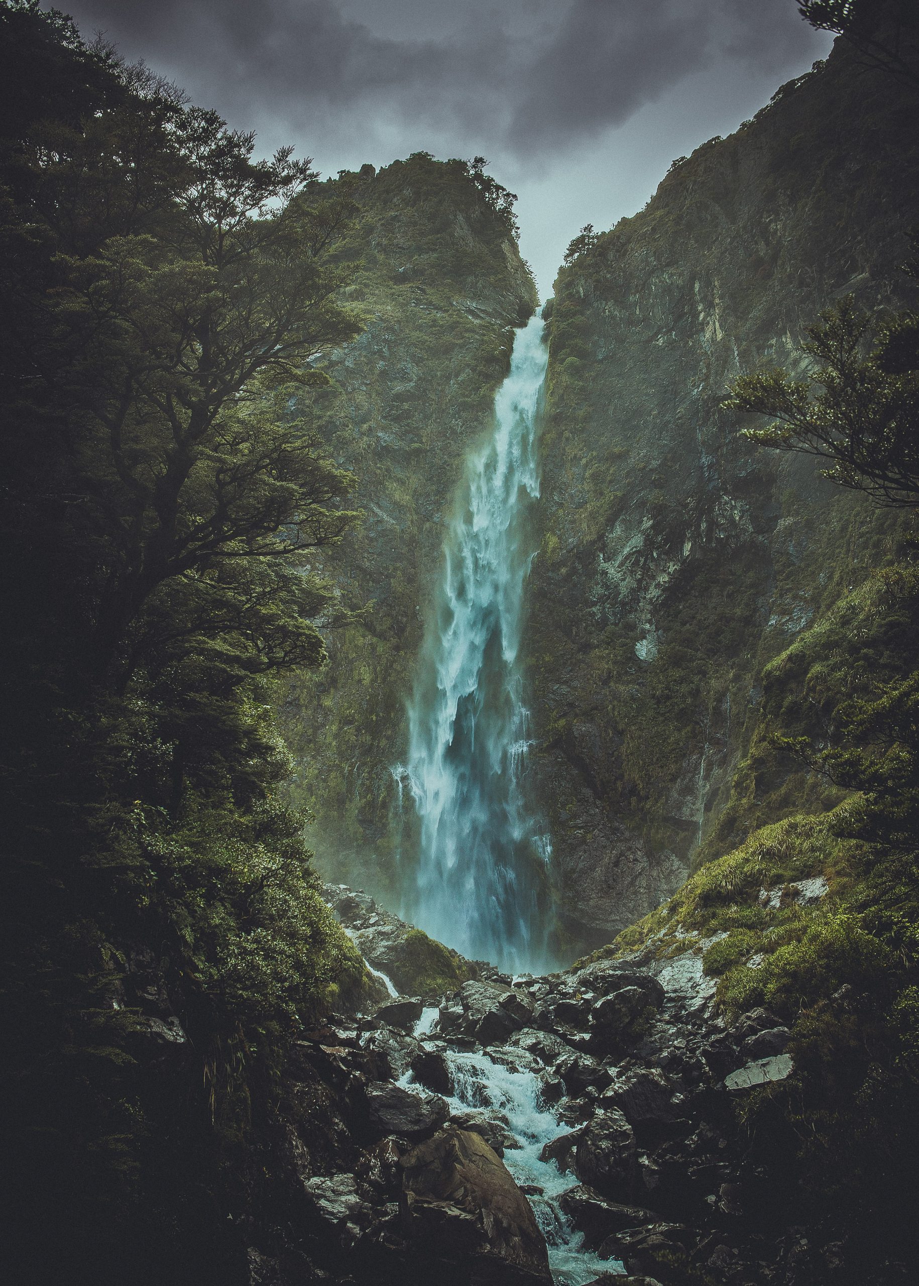
Length: 1.8km return
Time: 40 min
Start point: Devil’s Punchbowl Carpark
Walk highlights: A short walk with some steps to Devil’s Punchbowl Falls. On route you’ll see great views of the rugged Arthur’s Pass.
31. Mangawhai Cliffs Walkway
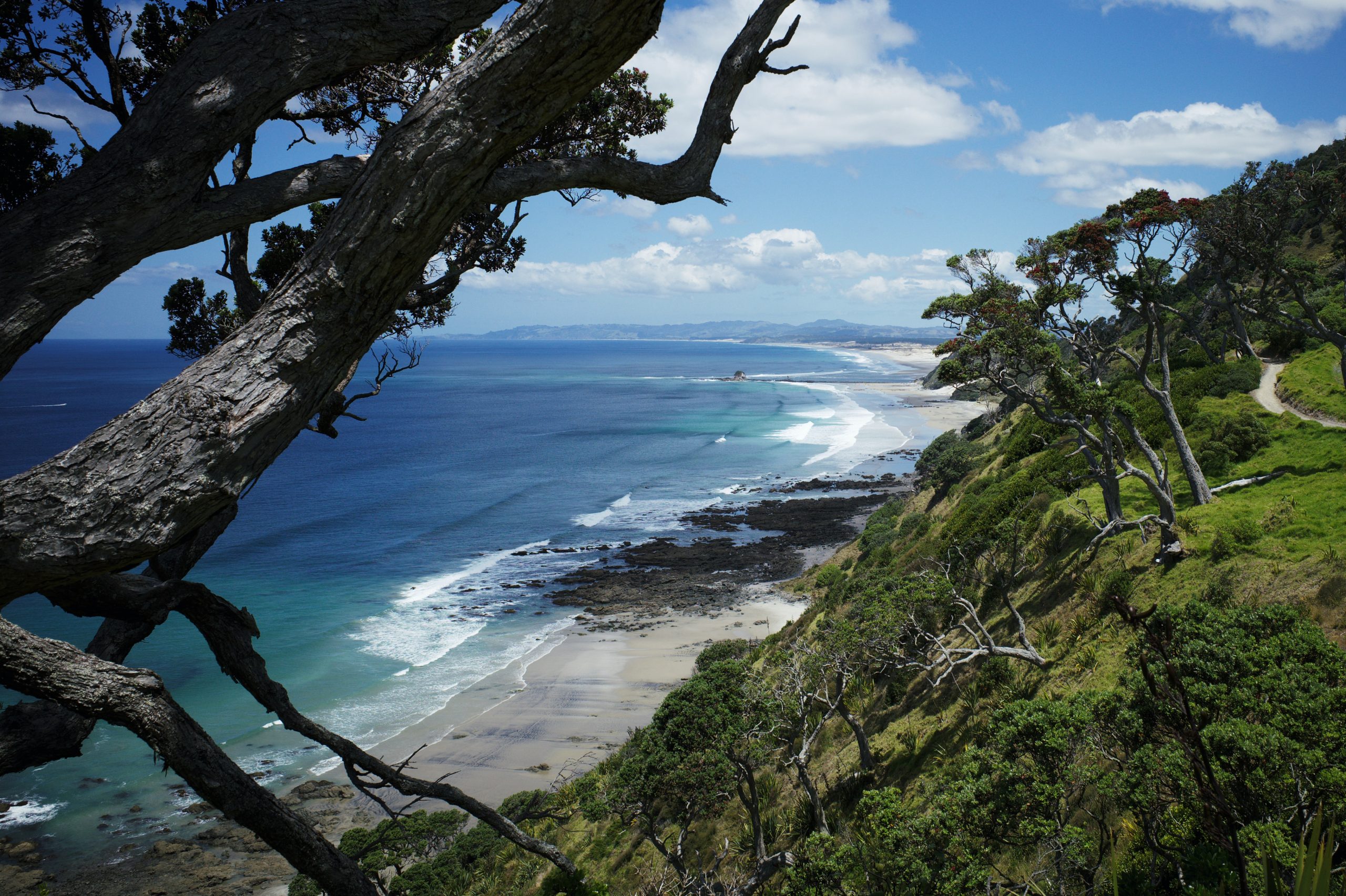
Length: 8.7km return
Time: 2h 30 min
Start point: Beach Car Park (Wintle St)
Walk highlights: A great clifftop walk above the ocean on the east coast of Northland. Instead of returning south on the same track, you could walk back along the beach instead (always check tide times).
32. Picton Snout Track
Length: 8km circular
Time: 2h 25 min
Start point: Snout Track Car Park
Walk highlights: A great walk up a narrow peninsula at the top of South Island to ‘The Snout’. Expect breathtaking views of the Marlborough Sounds.
33. Castlepoint Track
Length: 4.5km circular
Time: 1h 15 min
Start point: Jetty Rd
Walk highlights: A coastal circular walk which takes you to the Castlepoint Lighthouse before joining the Deliverance Cove Track for more epic ocean views.
34. Tunnel Beach Walkway
Length: 1.8km return
Time: 50 min
Start point: Tunnel Beach Parking
Walk highlights: Tunnel Beach is a rugged beach with a natural arch, accessed by a historic hand-carved tunnel built into the cliff. The short walk is tranquil and provides great views.
35. Cooks Cove Walkway
Length: 5km return
Time: 1h 30 min
Start point: Wharf Rd
Walk highlights: A great coastal walk along the cliffs to Cooks Cove Lookout, where you’ll see the long jetty of Tolaga Bay Wharf reaching out into the ocean.
36. Wharariki Beach Loop
Length: 4.5km circular
Time: 1h
Start point: Wharariki Beach Carpark
Walk highlights: A kid-friendly walk to Wharariki Beach and through the lush headland around it. When the tide is out, you can also walk all the way along the beach and witness Archway Islands.
37. Putangirua Pinnacles Track Loop
Length: 4.7km circular
Time: 1h 45 min
Start point: Putangirua Pinnacles Campsite
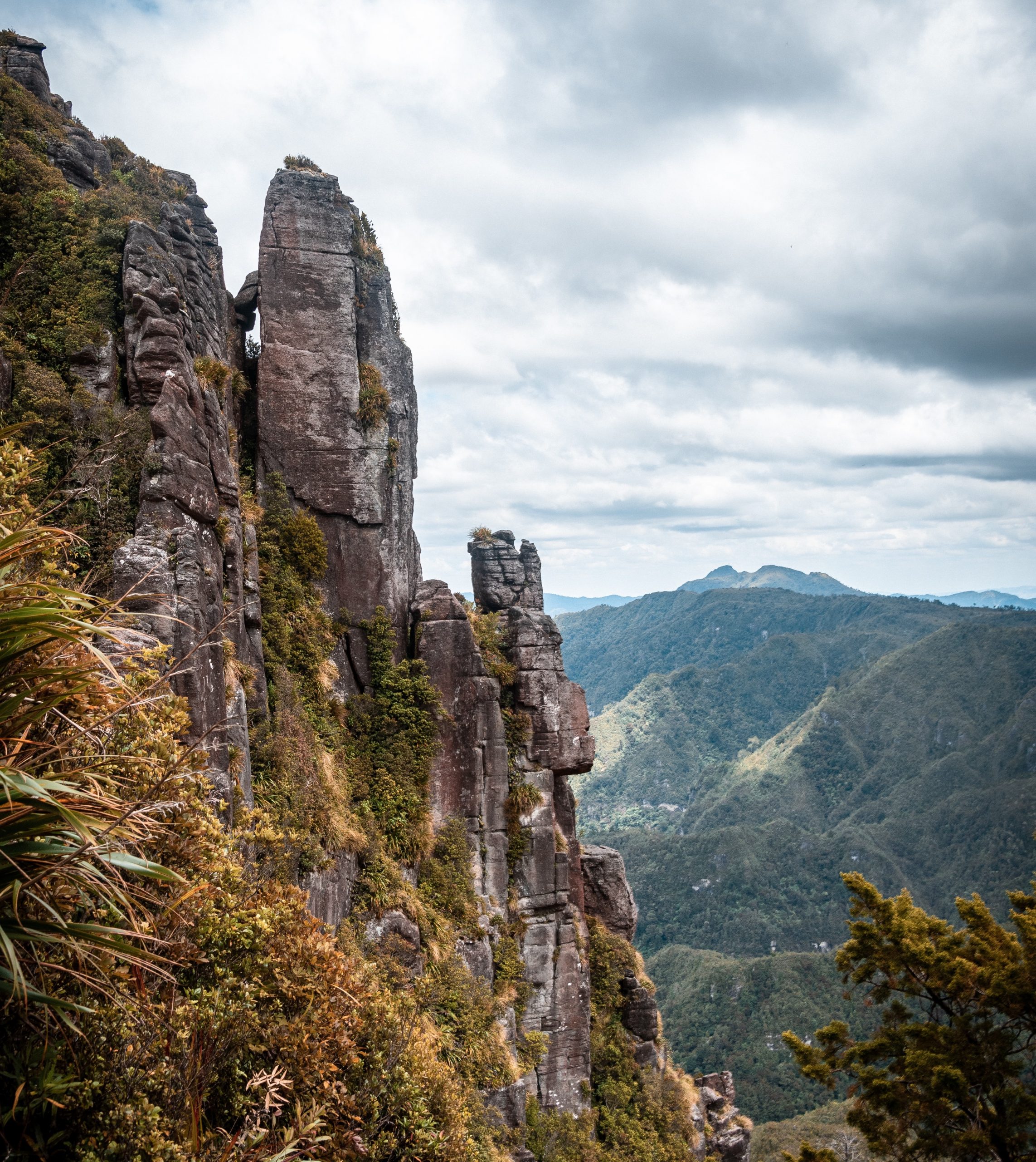
Walk highlights: A moderate walk below the Putangirua Pinnacles, a geological formation of ‘earth pillars’ in the Wellington region. You’ll also go past the Pinnacles Lookout for some great panoramic views of the Aorangi Ranges.
38. Tawharanui Ecology Path
Length: 3.5km circular
Time: 1h 10 min
Start point: Anchor Bay Car Park
Walk highlights: An easy walk in Tawharanui Regional Park through native bush and headlands overlooking the golden sands of Anchor Bay Beach. Look out for abundant birdlife (for this reason no dogs are allowed on this track).
39. Cape Foulwind Walkway
Length: 6km return
Time: 1h 35 min
Start point: Lighthouse Rd Public Parking
Walk highlights: A coastal walk on New Zealand’s ‘wild west coast’. Starting at Cape Foulwind Lighthouse, you’ll hug the lush-yet-rugged coastline before arriving at Tauranga Bay Seal Colony to spot some furry friends.
40. Blue Spring via Te Waihou Walkway
Length: 4.7km circular
Time: 1h 10 min
Start point: The Blue Spring Car Park
Walk highlights: An amazing walk along the Te Waihou Walkway to Blue Spring Putaruru, a natural spring known for its clear blue and green water.
41. Rakaia Gorge Walkway
Length: 9.2km circular
Time: 3h 5 min
Start point: Evans Reserve Parking
Walk highlights: A great walk along the bright turquoise waters of the Rakaia Gorge. You can also see snow-capped mountains in the backdrop.
42. Mount Manaia Track
Length: 3.7km return
Time: 1h 45 min
Start point: Mount Manaia Track Car Park
Walk highlights: A quick but challenging uphill tramp to the summit of Mount Manaia, where you’ll see views of Whangārei Heads and the bay beyond.
43. Pororari River Track
Length: 6.9km return
Time: 1h 55 min
Start point: Punakaiki Town Centre
Walk highlights: A great walk along the Pororari River, flanked by lush rainforest and towering cliffs.
44. Matiu/ Somes Island Loop Trail
Length: 4.2km circular
Time: 1h 10 min
Start point: Matiu/ Somes Island Wharf
Walk highlights: A walk around Matiu/ Somes Island, which sits in Wellington Harbour. You’ll need to get to Matiu/ Somes Island by ferry, but once you’re there you’ll witness brilliant views of the scenery around the capital city.
45. Tapeka Point Track
Length: 1km return
Time: 20min
Start point: Du Fresne Pl
Walk highlights: A quick walk near the old colonial town of Russell to Tapeka Point Lookout, a viewpoint offering great views over the Bay of Islands.
I hope you enjoyed my guide to the best New Zealand short walks and hikes 2022! Don’t miss my Ultimate New Zealand Road Trip Itinerary or my guide to the Best Viewpoints and Lookouts in New Zealand.